


Voting District 070001, Tioga County, New York
About
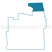
Outline

Summary
| Unique Area Identifier | 637885 |
| Name | Voting District 070001 |
| County | Tioga County |
| State | New York |
| Area (square miles) | 38.21 |
| Land Area (square miles) | 38.19 |
| Water Area (square miles) | 0.02 |
| % of Land Area | 99.95 |
| % of Water Area | 0.05 |
| Latitude of the Internal Point | 42.37492850 |
| Longtitude of the Internal Point | -76.19401500 |
Maps


Graphs
Select a template below for downloading or customizing gragh for Voting District 070001, Tioga County, New York


Neighbors
Neighoring Voting District (by Name) Neighboring Voting District on the Map
- Voting District 010001, Tompkins County, NY
- Voting District 010002, Tompkins County, NY
- Voting District 020001, Tioga County, NY
- Voting District 060001, Cortland County, NY
- Voting District 080001, Cortland County, NY
- Voting District 100002, Broome County, NY
Top 10 Neighboring County Subdivision (by Population) Neighboring County Subdivision on the Map
- Caroline town, Tompkins County, NY (3,282)
- Lisle town, Broome County, NY (2,751)
- Berkshire town, Tioga County, NY (1,412)
- Richford town, Tioga County, NY (1,172)
- Harford town, Cortland County, NY (943)
- Lapeer town, Cortland County, NY (767)
Top 10 Neighboring Unified School District (by Population) Neighboring Unified School District on the Map
- Ithaca City School District, NY (65,694)
- Dryden Central School District, NY (13,012)
- Whitney Point Central School District, NY (9,080)
- Newark Valley Central School District, NY (7,784)
- Marathon Central School District, NY (4,526)
Top 10 Neighboring State Legislative District Lower Chamber (by Population) Neighboring State Legislative District Lower Chamber on the Map
Top 10 Neighboring State Legislative District Upper Chamber (by Population) Neighboring State Legislative District Upper Chamber on the Map
Top 10 Neighboring 111th Congressional District (by Population) Neighboring 111th Congressional District on the Map
Top 10 Neighboring Census Tract (by Population) Neighboring Census Tract on the Map
- Census Tract 201, Tioga County, NY (6,530)
- Census Tract 19, Tompkins County, NY (6,099)
- Census Tract 9712, Cortland County, NY (4,111)
- Census Tract 119.03, Broome County, NY (2,751)