


Voting District 0200014, Suffolk County, New York
About
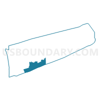
Outline

Summary
| Unique Area Identifier | 637341 |
| Name | Voting District 0200014 |
| County | Suffolk County |
| State | New York |
| Area (square miles) | 117.63 |
| Land Area (square miles) | 5.05 |
| Water Area (square miles) | 112.58 |
| % of Land Area | 4.30 |
| % of Water Area | 95.70 |
| Latitude of the Internal Point | 40.68213770 |
| Longtitude of the Internal Point | -73.00675890 |
Maps


Graphs
Select a template below for downloading or customizing gragh for Voting District 0200014, Suffolk County, New York


Neighbors
Neighoring Voting District (by Name) Neighboring Voting District on the Map
- Voting District 0200015, Suffolk County, NY
- Voting District 0200019, Suffolk County, NY
- Voting District 0200020, Suffolk County, NY
- Voting District 0200025, Suffolk County, NY
- Voting District 0200027, Suffolk County, NY
- Voting District 0200031, Suffolk County, NY
- Voting District 0200039, Suffolk County, NY
- Voting District 0200042, Suffolk County, NY
- Voting District 0200048, Suffolk County, NY
- Voting District 0200051, Suffolk County, NY
- Voting District 0200052 0200173, Suffolk County, NY
- Voting District 0200057, Suffolk County, NY
- Voting District 0200073, Suffolk County, NY
- Voting District 0200079, Suffolk County, NY
- Voting District 0200080, Suffolk County, NY
- Voting District 0200123, Suffolk County, NY
- Voting District 0200131, Suffolk County, NY
- Voting District 0200151, Suffolk County, NY
- Voting District 0200154, Suffolk County, NY
- Voting District 0200171, Suffolk County, NY
- Voting District 0200229, Suffolk County, NY
- Voting District 0200268, Suffolk County, NY
- Voting District 0200287, Suffolk County, NY
- Voting District 0500008, Suffolk County, NY
- Voting District 0900000, Suffolk County, NY
- Voting District 0900010, Suffolk County, NY
- Voting District 0900011, Suffolk County, NY
Top 10 Neighboring County Subdivision (by Population) Neighboring County Subdivision on the Map
- Brookhaven town, Suffolk County, NY (486,040)
- Islip town, Suffolk County, NY (335,543)
- Southampton town, Suffolk County, NY (56,790)
Top 10 Neighboring Place (by Population) Neighboring Place on the Map
- Shirley CDP, NY (27,854)
- East Patchogue CDP, NY (22,469)
- Mastic Beach CDP, NY (12,930)
- Patchogue village, NY (11,798)
- Center Moriches CDP, NY (7,580)
- East Moriches CDP, NY (5,249)
- Blue Point CDP, NY (4,773)
- Brookhaven CDP, NY (3,451)
- Bellport village, NY (2,084)
- Eastport CDP, NY (1,831)
Top 10 Neighboring Elementary School District (by Population) Neighboring Elementary School District on the Map
Top 10 Neighboring Unified School District (by Population) Neighboring Unified School District on the Map
- Patchogue-Medford Union Free School District, NY (52,929)
- William Floyd Union Free School District, NY (49,854)
- South Country Central School District, NY (29,858)
- Eastport-South Manor Central School District, NY (18,927)
- Bayport-Blue Point Union Free School District, NY (13,965)
- Center Moriches Union Free School District, NY (7,546)
- East Moriches Union Free School District, NY (5,755)
- Fire Island Union Free School District, NY (408)
Top 10 Neighboring State Legislative District Lower Chamber (by Population) Neighboring State Legislative District Lower Chamber on the Map
- Assembly District 3, NY (143,108)
- Assembly District 2, NY (142,833)
- Assembly District 5, NY (131,677)
Top 10 Neighboring State Legislative District Upper Chamber (by Population) Neighboring State Legislative District Upper Chamber on the Map
- State Senate District 1, NY (341,254)
- State Senate District 3, NY (322,962)
- State Senate District 4, NY (309,135)
Top 10 Neighboring 111th Congressional District (by Population) Neighboring 111th Congressional District on the Map
Top 10 Neighboring Census Tract (by Population) Neighboring Census Tract on the Map
- Census Tract 1595.06, Suffolk County, NY (8,793)
- Census Tract 1595.05, Suffolk County, NY (7,998)
- Census Tract 1595.08, Suffolk County, NY (7,464)
- Census Tract 1596.01, Suffolk County, NY (6,212)
- Census Tract 1592.03, Suffolk County, NY (5,418)
- Census Tract 1588.02, Suffolk County, NY (4,773)
- Census Tract 1590, Suffolk County, NY (4,679)
- Census Tract 1596.02, Suffolk County, NY (4,249)
- Census Tract 1592.04, Suffolk County, NY (4,226)
- Census Tract 1905.03, Suffolk County, NY (3,368)
Top 10 Neighboring 5-Digit ZIP Code Tabulation Area (by Population) Neighboring 5-Digit ZIP Code Tabulation Area on the Map
- 11706, NY (62,543)
- 11772, NY (44,837)
- 11967, NY (26,583)
- 11782, NY (15,814)
- 11951, NY (13,680)
- 11713, NY (10,401)
- 11934, NY (7,263)
- 11940, NY (5,210)
- 11715, NY (4,752)
- 11719, NY (3,589)