


Voting District 250001, Oneida County, New York
About
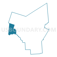
Outline

Summary
| Unique Area Identifier | 633000 |
| Name | Voting District 250001 |
| County | Oneida County |
| State | New York |
| Area (square miles) | 62.30 |
| Land Area (square miles) | 29.30 |
| Water Area (square miles) | 33.00 |
| % of Land Area | 47.04 |
| % of Water Area | 52.96 |
| Latitude of the Internal Point | 43.23103920 |
| Longtitude of the Internal Point | -75.82050410 |
Maps


Graphs
Select a template below for downloading or customizing gragh for Voting District 250001, Oneida County, New York


Neighbors
Neighoring Voting District (by Name) Neighboring Voting District on the Map
- Voting District 040001, Oswego County, NY
- Voting District 060002, Oneida County, NY
- Voting District 060003, Oneida County, NY
- Voting District 090001, Madison County, NY
- Voting District 160004 160009, Madison County, NY
- Voting District 160011, Madison County, NY
- Voting District 240006, Oneida County, NY
- Voting District 250002, Oneida County, NY
- Voting District 250004, Oneida County, NY
Top 10 Neighboring County Subdivision (by Population) Neighboring County Subdivision on the Map
- Sullivan town, Madison County, NY (15,339)
- Lenox town, Madison County, NY (9,122)
- Verona town, Oneida County, NY (6,293)
- Vienna town, Oneida County, NY (5,440)
- Constantia town, Oswego County, NY (4,973)
- Camden town, Oneida County, NY (4,934)
Top 10 Neighboring Place (by Population) Neighboring Place on the Map
Top 10 Neighboring Unified School District (by Population) Neighboring Unified School District on the Map
- Central Square Central School District, NY (25,262)
- Oneida City School District, NY (15,565)
- Chittenango Central School District, NY (13,920)
- Camden Central School District, NY (13,328)
- Canastota Central School District, NY (9,917)
Top 10 Neighboring State Legislative District Lower Chamber (by Population) Neighboring State Legislative District Lower Chamber on the Map
Top 10 Neighboring State Legislative District Upper Chamber (by Population) Neighboring State Legislative District Upper Chamber on the Map
- State Senate District 49, NY (296,854)
- State Senate District 48, NY (294,748)
- State Senate District 47, NY (292,134)
Top 10 Neighboring 111th Congressional District (by Population) Neighboring 111th Congressional District on the Map
Top 10 Neighboring Census Tract (by Population) Neighboring Census Tract on the Map
- Census Tract 9404.01, Madison County, NY (7,309)
- Census Tract 9401, Oneida County, NY (6,293)
- Census Tract 267, Oneida County, NY (5,440)
- Census Tract 206, Oswego County, NY (4,973)
- Census Tract 245, Oneida County, NY (4,934)
- Census Tract 9402, Madison County, NY (3,525)
Top 10 Neighboring 5-Digit ZIP Code Tabulation Area (by Population) Neighboring 5-Digit ZIP Code Tabulation Area on the Map
- 13032, NY (12,790)
- 13037, NY (8,897)
- 13316, NY (6,460)
- 13030, NY (3,892)
- 13308, NY (3,625)
- 13042, NY (2,356)
- 13157, NY (695)
- 13162, NY (385)
- 13123, NY (314)