


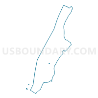
Voting District 7500065, New York County, New York
About
Outline

Summary
| Unique Area Identifier | 631958 |
| Name | Voting District 7500065 |
| County | New York County |
| State | New York |
| Area (square miles) | 0.01 |
| Land Area (square miles) | 0.01 |
| Water Area (square miles) | 0.00 |
| % of Land Area | 100.00 |
| % of Water Area | 0.00 |
| Latitude of the Internal Point | 40.74809500 |
| Longtitude of the Internal Point | -73.97693490 |
Maps

Graphs
Select a template below for downloading or customizing gragh for Voting District 7500065, New York County, New York


Neighbors
Neighoring Voting District (by Name) Neighboring Voting District on the Map
- Voting District 7300001, New York County, NY
- Voting District 7400102, New York County, NY
- Voting District 7400103, New York County, NY
- Voting District 7500063, New York County, NY
- Voting District 7500064, New York County, NY
- Voting District 7500066, New York County, NY
- Voting District 7500067, New York County, NY
- Voting District 7500068, New York County, NY
Top 10 Neighboring County Subdivision (by Population) Neighboring County Subdivision on the Map
Top 10 Neighboring Place (by Population) Neighboring Place on the Map
Top 10 Neighboring Unified School District (by Population) Neighboring Unified School District on the Map
Top 10 Neighboring State Legislative District Lower Chamber (by Population) Neighboring State Legislative District Lower Chamber on the Map
- Assembly District 75, NY (149,377)
- Assembly District 74, NY (133,261)
- Assembly District 73, NY (129,766)