


Voting District 0000000, Monroe County, New York
About
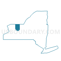
Outline

Summary
| Unique Area Identifier | 629662 |
| Name | Voting District 0000000 |
| County | Monroe County |
| State | New York |
| Area (square miles) | 694.70 |
| Land Area (square miles) | 0.00 |
| Water Area (square miles) | 694.70 |
| % of Land Area | 0.00 |
| % of Water Area | 100.00 |
| Latitude of the Internal Point | 43.46447510 |
| Longtitude of the Internal Point | -77.66465560 |
Maps


Graphs
Select a template below for downloading or customizing gragh for Voting District 0000000, Monroe County, New York


Neighbors
Neighoring Voting District (by Name) Neighboring Voting District on the Map
- Voting District 000000, Orleans County, NY
- Voting District 000000, Wayne County, NY
- Voting District 0500001, Monroe County, NY
- Voting District 0500002, Monroe County, NY
- Voting District 0500034, Monroe County, NY
- Voting District 0500038, Monroe County, NY
- Voting District 0500074, Monroe County, NY
- Voting District 0500076, Monroe County, NY
- Voting District 0600002, Monroe County, NY
- Voting District 0600007, Monroe County, NY
- Voting District 0800003, Monroe County, NY
- Voting District 0800049, Monroe County, NY
- Voting District 1100009, Monroe County, NY
- Voting District 1100010, Monroe County, NY
- Voting District 1607001, Monroe County, NY
- Voting District 1607002, Monroe County, NY
- Voting District 1629004, Monroe County, NY
- Voting District 1900013, Monroe County, NY
- Voting District 1900019, Monroe County, NY
- Voting District 1900020, Monroe County, NY
- Voting District 1900041, Monroe County, NY
Top 10 Neighboring County Subdivision (by Population) Neighboring County Subdivision on the Map
- Rochester city, Monroe County, NY (210,565)
- Greece town, Monroe County, NY (96,095)
- Irondequoit town, Monroe County, NY (51,692)
- Webster town, Monroe County, NY (42,641)
- Parma town, Monroe County, NY (15,633)
- Hamlin town, Monroe County, NY (9,045)
- County subdivisions not defined, Wayne County, NY (0)
- County subdivisions not defined, Orleans County, NY (0)
- County subdivisions not defined, Monroe County, NY (0)
Top 10 Neighboring Place (by Population) Neighboring Place on the Map
Top 10 Neighboring Unified School District (by Population) Neighboring Unified School District on the Map
- Rochester City School District, NY (210,596)
- Greece Central School District, NY (82,633)
- Webster Central School District, NY (55,982)
- East Irondequoit Central School District, NY (27,907)
- Brockport Central School District, NY (27,321)
- Hilton Central School District, NY (26,553)
- West Irondequoit Central School District, NY (23,754)
- Wayne Central School District, NY (15,070)
- School District Not Defined, NY (13,644)
- Kendall Central School District, NY (5,146)
Top 10 Neighboring State Legislative District Lower Chamber (by Population) Neighboring State Legislative District Lower Chamber on the Map
- Assembly District 135, NY (131,932)
- Assembly District 134, NY (130,126)
- Assembly District 139, NY (127,086)
- Assembly District 128, NY (126,373)
- Assembly District 132, NY (125,431)
Top 10 Neighboring State Legislative District Upper Chamber (by Population) Neighboring State Legislative District Upper Chamber on the Map
- State Senate District 55, NY (309,516)
- State Senate District 62, NY (304,003)
- State Senate District 54, NY (302,881)
- State Senate District 56, NY (297,343)
Top 10 Neighboring 111th Congressional District (by Population) Neighboring 111th Congressional District on the Map
Top 10 Neighboring Census Tract (by Population) Neighboring Census Tract on the Map
- Census Tract 113.01, Monroe County, NY (7,878)
- Census Tract 113.02, Monroe County, NY (5,576)
- Census Tract 151.01, Monroe County, NY (4,828)
- Census Tract 151.02, Monroe County, NY (4,217)
- Census Tract 134.01, Monroe County, NY (4,043)
- Census Tract 101, Monroe County, NY (3,799)
- Census Tract 85, Monroe County, NY (3,678)
- Census Tract 134.02, Monroe County, NY (3,456)
- Census Tract 107, Monroe County, NY (3,447)
- Census Tract 148.03, Monroe County, NY (3,351)
Top 10 Neighboring 5-Digit ZIP Code Tabulation Area (by Population) Neighboring 5-Digit ZIP Code Tabulation Area on the Map
- 14580, NY (50,587)
- 14612, NY (34,515)
- 14617, NY (22,789)
- 14468, NY (17,813)
- 14622, NY (12,108)
- 14464, NY (7,524)