


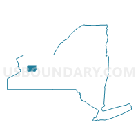
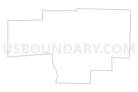
Voting District 120001, Genesee County, New York
About
Outline

Summary
| Unique Area Identifier | 627332 |
| Name | Voting District 120001 |
| County | Genesee County |
| State | New York |
| Area (square miles) | 21.94 |
| Land Area (square miles) | 21.91 |
| Water Area (square miles) | 0.03 |
| % of Land Area | 99.87 |
| % of Water Area | 0.13 |
| Latitude of the Internal Point | 42.91742440 |
| Longtitude of the Internal Point | -78.00123420 |
Maps


Graphs
Select a template below for downloading or customizing gragh for Voting District 120001, Genesee County, New York


Neighbors
Neighoring Voting District (by Name) Neighboring Voting District on the Map
- Voting District 020001, Livingston County, NY
- Voting District 060001, Genesee County, NY
- Voting District 100002, Genesee County, NY
- Voting District 100003, Genesee County, NY
- Voting District 100004, Genesee County, NY
- Voting District 100005, Genesee County, NY
- Voting District 120002, Genesee County, NY
- Voting District 140003, Genesee County, NY
- Voting District 170001, Livingston County, NY
Top 10 Neighboring County Subdivision (by Population) Neighboring County Subdivision on the Map
- Le Roy town, Genesee County, NY (7,641)
- Caledonia town, Livingston County, NY (4,255)
- York town, Livingston County, NY (3,397)
- Pavilion town, Genesee County, NY (2,495)
- Stafford town, Genesee County, NY (2,459)
- Bethany town, Genesee County, NY (1,765)
Top 10 Neighboring Place (by Population) Neighboring Place on the Map
Top 10 Neighboring Unified School District (by Population) Neighboring Unified School District on the Map
- Le Roy Central School District, NY (8,405)
- Caledonia-Mumford Central School District, NY (5,744)
- York Central School District, NY (5,229)
- Pavilion Central School District, NY (4,718)
Top 10 Neighboring State Legislative District Lower Chamber (by Population) Neighboring State Legislative District Lower Chamber on the Map
Top 10 Neighboring State Legislative District Upper Chamber (by Population) Neighboring State Legislative District Upper Chamber on the Map
Top 10 Neighboring 111th Congressional District (by Population) Neighboring 111th Congressional District on the Map
Top 10 Neighboring Census Tract (by Population) Neighboring Census Tract on the Map
- Census Tract 9511, Genesee County, NY (5,361)
- Census Tract 302.01, Livingston County, NY (5,237)
- Census Tract 9513, Genesee County, NY (4,260)
- Census Tract 301, Livingston County, NY (4,255)
Top 10 Neighboring 5-Digit ZIP Code Tabulation Area (by Population) Neighboring 5-Digit ZIP Code Tabulation Area on the Map
- 14482, NY (8,275)
- 14423, NY (4,799)
- 14525, NY (2,865)
- 14054, NY (1,344)
- 14143, NY (1,214)
- 14486, NY (308)