


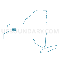
Voting District 140002, Genesee County, New York
About
Outline

Summary
| Unique Area Identifier | 627304 |
| Name | Voting District 140002 |
| County | Genesee County |
| State | New York |
| Area (square miles) | 8.11 |
| Land Area (square miles) | 8.03 |
| Water Area (square miles) | 0.07 |
| % of Land Area | 99.10 |
| % of Water Area | 0.90 |
| Latitude of the Internal Point | 42.99382890 |
| Longtitude of the Internal Point | -78.08394660 |
Maps


Graphs
Select a template below for downloading or customizing gragh for Voting District 140002, Genesee County, New York


Neighbors
Neighoring Voting District (by Name) Neighboring Voting District on the Map
- Voting District 030003, Genesee County, NY
- Voting District 100001, Genesee County, NY
- Voting District 100006, Genesee County, NY
- Voting District 140001, Genesee County, NY
- Voting District 140003, Genesee County, NY
Top 10 Neighboring County Subdivision (by Population) Neighboring County Subdivision on the Map
- Le Roy town, Genesee County, NY (7,641)
- Batavia town, Genesee County, NY (6,809)
- Stafford town, Genesee County, NY (2,459)
Top 10 Neighboring Unified School District (by Population) Neighboring Unified School District on the Map
- Batavia City School District, NY (19,073)
- Le Roy Central School District, NY (8,405)
- Byron-Bergen Central School District, NY (7,318)