


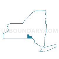
Voting District 120001, Broome County, New York
About
Outline

Summary
| Unique Area Identifier | 625599 |
| Name | Voting District 120001 |
| County | Broome County |
| State | New York |
| Area (square miles) | 24.36 |
| Land Area (square miles) | 24.27 |
| Water Area (square miles) | 0.09 |
| % of Land Area | 99.63 |
| % of Water Area | 0.37 |
| Latitude of the Internal Point | 42.28493660 |
| Longtitude of the Internal Point | -76.02658600 |
Maps


Graphs
Select a template below for downloading or customizing gragh for Voting District 120001, Broome County, New York


Neighbors
Neighoring Voting District (by Name) Neighboring Voting District on the Map
- Voting District 010002, Broome County, NY
- Voting District 020001, Tioga County, NY
- Voting District 040001, Tioga County, NY
- Voting District 100002, Broome County, NY
- Voting District 110002-110004, Broome County, NY
- Voting District 140002, Broome County, NY
Top 10 Neighboring County Subdivision (by Population) Neighboring County Subdivision on the Map
- Maine town, Broome County, NY (5,377)
- Newark Valley town, Tioga County, NY (3,946)
- Triangle town, Broome County, NY (2,946)
- Lisle town, Broome County, NY (2,751)
- Barker town, Broome County, NY (2,732)
- Nanticoke town, Broome County, NY (1,672)
- Berkshire town, Tioga County, NY (1,412)
Top 10 Neighboring Place (by Population) Neighboring Place on the Map
Top 10 Neighboring Unified School District (by Population) Neighboring Unified School District on the Map
- Maine-Endwell Central School District, NY (15,013)
- Whitney Point Central School District, NY (9,080)
- Newark Valley Central School District, NY (7,784)
Top 10 Neighboring State Legislative District Lower Chamber (by Population) Neighboring State Legislative District Lower Chamber on the Map
Top 10 Neighboring State Legislative District Upper Chamber (by Population) Neighboring State Legislative District Upper Chamber on the Map
Top 10 Neighboring 111th Congressional District (by Population) Neighboring 111th Congressional District on the Map
Top 10 Neighboring Census Tract (by Population) Neighboring Census Tract on the Map
- Census Tract 201, Tioga County, NY (6,530)
- Census Tract 102, Broome County, NY (5,377)
- Census Tract 119.01, Broome County, NY (2,946)
- Census Tract 119.03, Broome County, NY (2,751)
- Census Tract 119.02, Broome County, NY (2,732)
- Census Tract 120, Broome County, NY (1,672)
Top 10 Neighboring 5-Digit ZIP Code Tabulation Area (by Population) Neighboring 5-Digit ZIP Code Tabulation Area on the Map
- 13905, NY (28,026)
- 13790, NY (19,104)
- 13811, NY (4,354)
- 13862, NY (4,189)
- 13736, NY (2,338)
- 13797, NY (2,250)
- 13777, NY (727)
- 13802, NY (718)