


Santa Fe County Precinct 57, Santa Fe County, New Mexico
About
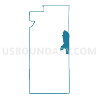
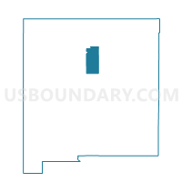
Outline

Summary
| Unique Area Identifier | 624115 |
| Name | Santa Fe County Precinct 57 |
| County | Santa Fe County |
| State | New Mexico |
| Area (square miles) | 69.04 |
| Land Area (square miles) | 69.04 |
| Water Area (square miles) | 0.00 |
| % of Land Area | 100.00 |
| % of Water Area | 0.00 |
| Latitude of the Internal Point | 35.60201670 |
| Longtitude of the Internal Point | -105.75970140 |
Maps

Graphs
Select a template below for downloading or customizing gragh for Santa Fe County Precinct 57, Santa Fe County, New Mexico


Neighbors
Neighoring Voting District (by Name) Neighboring Voting District on the Map
- San Miguel County Precinct 22, San Miguel County, NM
- San Miguel County Precinct 23, San Miguel County, NM
- Santa Fe County Precinct 13, Santa Fe County, NM
- Santa Fe County Precinct 17, Santa Fe County, NM
- Santa Fe County Precinct 48, Santa Fe County, NM
- Santa Fe County Precinct 63, Santa Fe County, NM
- Santa Fe County Precinct 9, Santa Fe County, NM
Top 10 Neighboring County Subdivision (by Population) Neighboring County Subdivision on the Map
- Santa Fe South CCD, Santa Fe County, NM (39,958)
- Santa Fe North CCD, Santa Fe County, NM (18,320)
- Pecos CCD, San Miguel County, NM (6,445)
- Villanueva CCD, San Miguel County, NM (2,457)
Top 10 Neighboring Place (by Population) Neighboring Place on the Map
Top 10 Neighboring Unified School District (by Population) Neighboring Unified School District on the Map
- Santa Fe Public Schools, NM (118,032)
- West Las Vegas Public Schools, NM (11,020)
- Pecos Independent Schools, NM (4,979)
Top 10 Neighboring State Legislative District Lower Chamber (by Population) Neighboring State Legislative District Lower Chamber on the Map
- State House District 50, NM (31,808)
- State House District 47, NM (28,195)
- State House District 40, NM (24,506)
Top 10 Neighboring State Legislative District Upper Chamber (by Population) Neighboring State Legislative District Upper Chamber on the Map
Top 10 Neighboring 111th Congressional District (by Population) Neighboring 111th Congressional District on the Map
Top 10 Neighboring Census Tract (by Population) Neighboring Census Tract on the Map
- Census Tract 9576, San Miguel County, NM (6,445)
- Census Tract 107, Santa Fe County, NM (5,371)
- Census Tract 108, Santa Fe County, NM (2,798)
- Census Tract 9577, San Miguel County, NM (2,457)
- Census Tract 103.09, Santa Fe County, NM (1,765)
- Census Tract 102.03, Santa Fe County, NM (1,286)
Top 10 Neighboring 5-Digit ZIP Code Tabulation Area (by Population) Neighboring 5-Digit ZIP Code Tabulation Area on the Map
- 87505, NM (31,013)
- 87508, NM (18,183)
- 87501, NM (15,147)
- 87552, NM (3,325)
- 87535, NM (1,270)
- 87562, NM (576)
- 87573, NM (36)