


Sandoval County Precinct 30, Sandoval County, New Mexico
About
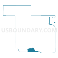
Outline

Summary
| Unique Area Identifier | 623923 |
| Name | Sandoval County Precinct 30 |
| County | Sandoval County |
| State | New Mexico |
| Area (square miles) | 63.34 |
| Land Area (square miles) | 63.33 |
| Water Area (square miles) | 0.01 |
| % of Land Area | 99.99 |
| % of Water Area | 0.01 |
| Latitude of the Internal Point | 35.25238020 |
| Longtitude of the Internal Point | -106.86148240 |
Maps


Graphs
Select a template below for downloading or customizing gragh for Sandoval County Precinct 30, Sandoval County, New Mexico


Neighbors
Neighoring Voting District (by Name) Neighboring Voting District on the Map
- Bernalillo County Precinct 1, Bernalillo County, NM
- Bernalillo County Precinct 116, Bernalillo County, NM
- Bernalillo County Precinct 2, Bernalillo County, NM
- Bernalillo County Precinct 31, Bernalillo County, NM
- Bernalillo County Precinct 57, Bernalillo County, NM
- Bernalillo County Precinct 81, Bernalillo County, NM
- Bernalillo County Precinct 87, Bernalillo County, NM
- Sandoval County Precinct 27, Sandoval County, NM
- Sandoval County Precinct 31, Sandoval County, NM
- Sandoval County Precinct 33, Sandoval County, NM
- Sandoval County Precinct 40, Sandoval County, NM
- Sandoval County Precinct 43, Sandoval County, NM
- Sandoval County Precinct 44, Sandoval County, NM
- Sandoval County Precinct 45, Sandoval County, NM
- Sandoval County Precinct 46, Sandoval County, NM
- Sandoval County Precinct 47, Sandoval County, NM
- Sandoval County Precinct 63, Sandoval County, NM
- Sandoval County Precinct 69, Sandoval County, NM
- Sandoval County Precinct 70, Sandoval County, NM
- Sandoval County Precinct 72, Sandoval County, NM
Top 10 Neighboring County Subdivision (by Population) Neighboring County Subdivision on the Map
- Albuquerque CCD, Bernalillo County, NM (633,223)
- Rio Rancho CCD, Sandoval County, NM (113,761)
- West Bernalillo CCD, Bernalillo County, NM (7,796)
- Cuba CCD, Sandoval County, NM (4,986)
Top 10 Neighboring Place (by Population) Neighboring Place on the Map
Top 10 Neighboring Unified School District (by Population) Neighboring Unified School District on the Map
- Albuquerque Public Schools, NM (667,445)
- Rio Rancho Public Schools, NM (89,033)
- Jemez Valley Public Schools, NM (5,273)
Top 10 Neighboring State Legislative District Lower Chamber (by Population) Neighboring State Legislative District Lower Chamber on the Map
- State House District 29, NM (59,097)
- State House District 44, NM (51,046)
- State House District 60, NM (41,212)
- State House District 12, NM (38,723)
- State House District 65, NM (26,930)
Top 10 Neighboring State Legislative District Upper Chamber (by Population) Neighboring State Legislative District Upper Chamber on the Map
- State Senate District 23, NM (84,821)
- State Senate District 22, NM (60,988)
- State Senate District 10, NM (57,103)
- State Senate District 9, NM (52,758)
Top 10 Neighboring 111th Congressional District (by Population) Neighboring 111th Congressional District on the Map
- Congressional District 1, NM (701,939)
- Congressional District 3, NM (693,284)
- Congressional District 2, NM (663,956)
Top 10 Neighboring Census Tract (by Population) Neighboring Census Tract on the Map
- Census Tract 107.23, Sandoval County, NM (9,954)
- Census Tract 9406, Bernalillo County, NM (9,385)
- Census Tract 47.17, Bernalillo County, NM (7,552)
- Census Tract 107.20, Sandoval County, NM (7,510)
- Census Tract 47.46, Bernalillo County, NM (7,037)
- Census Tract 47.45, Bernalillo County, NM (6,396)
- Census Tract 107.05, Sandoval County, NM (5,997)
- Census Tract 107.13, Sandoval County, NM (5,357)
- Census Tract 107.12, Sandoval County, NM (5,173)
- Census Tract 107.22, Sandoval County, NM (4,908)