


Thomas Precinct, Thomas County, Nebraska
About
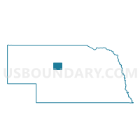
Outline

Summary
| Unique Area Identifier | 613981 |
| Name | Thomas Precinct |
| County | Thomas County |
| State | Nebraska |
| Area (square miles) | 714.02 |
| Land Area (square miles) | 713.24 |
| Water Area (square miles) | 0.78 |
| % of Land Area | 99.89 |
| % of Water Area | 0.11 |
| Latitude of the Internal Point | 41.84862020 |
| Longtitude of the Internal Point | -100.50691050 |
Maps


Graphs
Select a template below for downloading or customizing gragh for Thomas Precinct, Thomas County, Nebraska


Neighbors
Neighoring Voting District (by Name) Neighboring Voting District on the Map
- Voting District 1P, Logan County, NE
- Blaine Precinct, Blaine County, NE
- Goose Creek Precinct, Cherry County, NE
- Hooker Precinct, Hooker County, NE
- Loup Precinct, Cherry County, NE
- Tyron Precinct, McPherson County, NE
- Wells Precinct, Cherry County, NE
Top 10 Neighboring County Subdivision (by Population) Neighboring County Subdivision on the Map
- Mullen precinct, Hooker County, NE (736)
- Thomas precinct, Thomas County, NE (647)
- Stapleton No. 1 precinct, Logan County, NE (292)
- Loup precinct, Cherry County, NE (233)
- Dunning precinct, Blaine County, NE (164)
- Purdum precinct, Blaine County, NE (133)
- Wells precinct, Cherry County, NE (129)
- Goose Creek precinct, Cherry County, NE (119)
- Hall precinct, McPherson County, NE (82)
Top 10 Neighboring Place (by Population) Neighboring Place on the Map
Top 10 Neighboring Unified School District (by Population) Neighboring Unified School District on the Map
- Valentine Community Schools, NE (4,515)
- Mullen Public Schools, NE (936)
- Stapleton Public Schools, NE (897)
- Sandhills Public Schools, NE (619)
- Thedford Public Schools, NE (561)
- McPherson County Schools, NE (560)
Top 10 Neighboring State Legislative District Upper Chamber (by Population) Neighboring State Legislative District Upper Chamber on the Map
Top 10 Neighboring 111th Congressional District (by Population) Neighboring 111th Congressional District on the Map
Top 10 Neighboring Census Tract (by Population) Neighboring Census Tract on the Map
- Census Tract 9559, Cherry County, NE (1,426)
- Census Tract 9575, Logan County, NE (763)
- Census Tract 9567, Hooker County, NE (736)
- Census Tract 9571, Thomas County, NE (647)
- Census Tract 9579, McPherson County, NE (539)
- Census Tract 9724, Blaine County, NE (478)
Top 10 Neighboring 5-Digit ZIP Code Tabulation Area (by Population) Neighboring 5-Digit ZIP Code Tabulation Area on the Map
- 69152, NE (886)
- 69163, NE (873)
- 69166, NE (600)
- 69167, NE (441)
- 68833, NE (299)
- 69142, NE (137)
- 69161, NE (81)
- 69135, NE (65)
- 69157, NE (21)