


Tilden Precinct, Antelope County, Nebraska
About
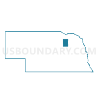
Outline

Summary
| Unique Area Identifier | 612423 |
| Name | Tilden Precinct |
| County | Antelope County |
| State | Nebraska |
| Area (square miles) | 71.41 |
| Land Area (square miles) | 71.05 |
| Water Area (square miles) | 0.37 |
| % of Land Area | 99.48 |
| % of Water Area | 0.52 |
| Latitude of the Internal Point | 41.99470150 |
| Longtitude of the Internal Point | -97.89056700 |
Maps


Graphs
Select a template below for downloading or customizing gragh for Tilden Precinct, Antelope County, Nebraska


Neighbors
Neighoring Voting District (by Name) Neighboring Voting District on the Map
- Meadow Grove-Jefferson-Grove-Highland Precinct, Madison County, NE
- Neligh Precinct, Antelope County, NE
- North Branch-Shell Creek Precinct, Boone County, NE
- Oakdale Precinct, Antelope County, NE
- Pierce Rural Area Precinct, Pierce County, NE
- Schoolcraft-Emerick-SCrk-NG Precinct, Madison County, NE
- Tilden 1st Ward, Antelope County, NE
- Tilden 2nd Ward Precinct, Madison County, NE
Top 10 Neighboring County Subdivision (by Population) Neighboring County Subdivision on the Map
- Meadow Grove-Jefferson precinct, Madison County, NE (673)
- Tilden city, Madison County, NE (629)
- Oakdale township, Antelope County, NE (407)
- Tilden city, Antelope County, NE (324)
- Burnett township, Antelope County, NE (175)
- North Branch-Shell Creek precinct, Boone County, NE (174)
- Grove precinct, Madison County, NE (162)
- Cedar township, Antelope County, NE (137)
- Emerick precinct, Madison County, NE (115)
- Elm township, Antelope County, NE (82)
Top 10 Neighboring Place (by Population) Neighboring Place on the Map
Top 10 Neighboring Unified School District (by Population) Neighboring Unified School District on the Map
- Boone Central Schools, NE (3,658)
- Neligh-Oakdale Schools, NE (2,536)
- Elkhorn Valley Schools, NE (1,987)
- Newman Grove Public Schools, NE (1,406)
- Elgin Public Schools, NE (1,332)
Top 10 Neighboring State Legislative District Upper Chamber (by Population) Neighboring State Legislative District Upper Chamber on the Map
- State Senate District 19, NE (34,876)
- State Senate District 41, NE (33,249)
- State Senate District 40, NE (31,744)
Top 10 Neighboring 111th Congressional District (by Population) Neighboring 111th Congressional District on the Map
Top 10 Neighboring Census Tract (by Population) Neighboring Census Tract on the Map
- Census Tract 9601, Boone County, NE (3,626)
- Census Tract 9612, Madison County, NE (3,513)
- Census Tract 9792, Pierce County, NE (3,440)
- Census Tract 9798, Antelope County, NE (2,781)
- Census Tract 9796, Antelope County, NE (2,146)