


Precinct 1, Sheridan County, Montana
About
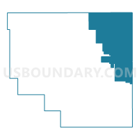
Outline

Summary
| Unique Area Identifier | 612271 |
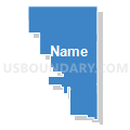
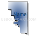
| Name | Precinct 1 |
| County | Sheridan County |
| State | Montana |
| Area (square miles) | 287.46 |
| Land Area (square miles) | 277.98 |
| Water Area (square miles) | 9.48 |
| % of Land Area | 96.70 |
| % of Water Area | 3.30 |
| Latitude of the Internal Point | 48.85636820 |
| Longtitude of the Internal Point | -104.17083000 |
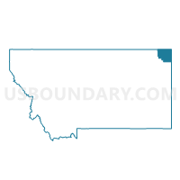
Maps

Graphs
Select a template below for downloading or customizing gragh for Precinct 1, Sheridan County, Montana


Neighbors
Neighoring Voting District (by Name) Neighboring Voting District on the Map
- Divide 02-03 Voting District, Divide County, ND
- Precinct 2, Sheridan County, MT
- Precinct 6, Sheridan County, MT
- Williams 2-67 Voting District, Williams County, ND
Top 10 Neighboring County Subdivision (by Population) Neighboring County Subdivision on the Map
- Plentywood CCD, Sheridan County, MT (2,378)
- Medicine Lake CCD, Sheridan County, MT (592)
- Westby CCD, Sheridan County, MT (326)
- Westby township, Divide County, ND (51)
- Daneville township, Divide County, ND (34)
- Elkhorn township, Divide County, ND (26)
- Fertile Valley township, Divide County, ND (23)
- Grenora township, Williams County, ND (8)
Top 10 Neighboring Place (by Population) Neighboring Place on the Map
Top 10 Neighboring Unified School District (by Population) Neighboring Unified School District on the Map
- Plentywood K-12 Schools, MT (2,434)
- Grenora Public School District 99, ND (652)
- Medicine Lake K-12 Schools, MT (620)
- Westby K-12 Schools, MT (330)
Top 10 Neighboring State Legislative District Lower Chamber (by Population) Neighboring State Legislative District Lower Chamber on the Map
Top 10 Neighboring State Legislative District Upper Chamber (by Population) Neighboring State Legislative District Upper Chamber on the Map
Top 10 Neighboring 111th Congressional District (by Population) Neighboring 111th Congressional District on the Map
Top 10 Neighboring Census Tract (by Population) Neighboring Census Tract on the Map
- Census Tract 902, Sheridan County, MT (2,378)
- Census Tract 9545, Divide County, ND (2,071)
- Census Tract 9535, Williams County, ND (1,676)
- Census Tract 904, Sheridan County, MT (1,006)