


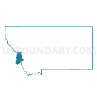
Precinct 15, Ravalli County, Montana
About
Outline

Summary
| Unique Area Identifier | 612230 |
| Name | Precinct 15 |
| County | Ravalli County |
| State | Montana |
| Area (square miles) | 76.63 |
| Land Area (square miles) | 76.18 |
| Water Area (square miles) | 0.45 |
| % of Land Area | 99.41 |
| % of Water Area | 0.59 |
| Latitude of the Internal Point | 46.44694350 |
| Longtitude of the Internal Point | -114.25607530 |
Maps


Graphs
Select a template below for downloading or customizing gragh for Precinct 15, Ravalli County, Montana


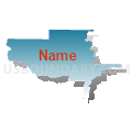
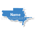


Neighbors
Neighoring Voting District (by Name) Neighboring Voting District on the Map
- Lowell Voting District, Idaho County, ID
- Precinct 10, Ravalli County, MT
- Precinct 12, Ravalli County, MT
- Precinct 14, Ravalli County, MT
- Precinct 16, Ravalli County, MT
Top 10 Neighboring County Subdivision (by Population) Neighboring County Subdivision on the Map
- Hamilton CCD, Ravalli County, MT (19,785)
- Stevensville CCD, Ravalli County, MT (14,158)
- Victor CCD, Ravalli County, MT (2,889)
- Elk City CCD, Idaho County, ID (2,075)
Top 10 Neighboring Place (by Population) Neighboring Place on the Map
Top 10 Neighboring Elementary School District (by Population) Neighboring Elementary School District on the Map
Top 10 Neighboring Secondary School District (by Population) Neighboring Secondary School District on the Map
Top 10 Neighboring Unified School District (by Population) Neighboring Unified School District on the Map
- Mountain View School District 244, ID (9,920)
- Corvallis K-12 Schools, MT (7,645)
- Victor K-12 Schools, MT (3,486)
Top 10 Neighboring State Legislative District Lower Chamber (by Population) Neighboring State Legislative District Lower Chamber on the Map
- State House District 8, ID (38,711)
- State House District 89, MT (10,221)
- State House District 87, MT (9,798)
Top 10 Neighboring State Legislative District Upper Chamber (by Population) Neighboring State Legislative District Upper Chamber on the Map
- State Senate District 8, ID (38,711)
- State Senate District 45, MT (20,547)
- State Senate District 44, MT (19,665)
Top 10 Neighboring 111th Congressional District (by Population) Neighboring 111th Congressional District on the Map
Top 10 Neighboring Census Tract (by Population) Neighboring Census Tract on the Map
- Census Tract 2.02, Ravalli County, MT (6,666)
- Census Tract 4.02, Ravalli County, MT (5,423)
- Census Tract 2.01, Ravalli County, MT (3,529)
- Census Tract 3, Ravalli County, MT (2,889)
- Census Tract 4.01, Ravalli County, MT (2,657)
- Census Tract 9601, Idaho County, ID (2,075)