


Precinct 13, Broadwater County, Montana
About
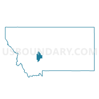
Outline

Summary
| Unique Area Identifier | 611841 |
| Name | Precinct 13 |
| County | Broadwater County |
| State | Montana |
| Area (square miles) | 444.61 |
| Land Area (square miles) | 442.02 |
| Water Area (square miles) | 2.59 |
| % of Land Area | 99.42 |
| % of Water Area | 0.58 |
| Latitude of the Internal Point | 46.13016520 |
| Longtitude of the Internal Point | -111.52527520 |
Maps


Graphs
Select a template below for downloading or customizing gragh for Precinct 13, Broadwater County, Montana


Neighbors
Neighoring Voting District (by Name) Neighboring Voting District on the Map
- Precinct 1, Broadwater County, MT
- Precinct 12, Broadwater County, MT
- Precinct 14, Gallatin County, MT
- Precinct 15, Gallatin County, MT
- Precinct 5, Meagher County, MT
- Precinct 7, Jefferson County, MT
- Precinct 7, Gallatin County, MT
- Precinct 8, Jefferson County, MT
Top 10 Neighboring County Subdivision (by Population) Neighboring County Subdivision on the Map
- Belgrade CCD, Gallatin County, MT (23,200)
- Boulder CCD, Jefferson County, MT (7,876)
- Whitehall CCD, Jefferson County, MT (3,530)
- Townsend East CCD, Broadwater County, MT (3,415)
- Three Forks CCD, Gallatin County, MT (3,098)
- Townsend West CCD, Broadwater County, MT (2,197)
- Martinsdale-Ringling CCD, Meagher County, MT (378)
Top 10 Neighboring Place (by Population) Neighboring Place on the Map
Top 10 Neighboring Elementary School District (by Population) Neighboring Elementary School District on the Map
- Three Forks Elementary School District, MT (3,509)
- Boulder Elementary School District, MT (2,000)
- White Sulphur Springs Elementary School District, MT (1,766)
- Cardwell Elementary School District, MT (409)
- Willow Creek Elementary School District, MT (338)
- Pass Creek Elementary School District, MT (95)
Top 10 Neighboring Secondary School District (by Population) Neighboring Secondary School District on the Map
- Jefferson High School District, MT (7,928)
- Manhattan High School District, MT (4,564)
- Whitehall High School District, MT (3,913)
- Three Forks High School District, MT (3,480)
- White Sulphur Springs High School District, MT (1,891)
- Willow Creek High School District, MT (275)
Top 10 Neighboring Unified School District (by Population) Neighboring Unified School District on the Map
Top 10 Neighboring State Legislative District Lower Chamber (by Population) Neighboring State Legislative District Lower Chamber on the Map
- State House District 69, MT (14,935)
- State House District 68, MT (10,656)
- State House District 77, MT (9,685)
- State House District 83, MT (9,653)
Top 10 Neighboring State Legislative District Upper Chamber (by Population) Neighboring State Legislative District Upper Chamber on the Map
- State Senate District 35, MT (26,667)
- State Senate District 34, MT (25,583)
- State Senate District 42, MT (20,506)
- State Senate District 39, MT (20,393)
Top 10 Neighboring 111th Congressional District (by Population) Neighboring 111th Congressional District on the Map
Top 10 Neighboring Census Tract (by Population) Neighboring Census Tract on the Map
- Census Tract 9622.02, Jefferson County, MT (3,977)
- Census Tract 2, Broadwater County, MT (3,535)
- Census Tract 9623, Jefferson County, MT (3,530)
- Census Tract 3, Gallatin County, MT (3,098)
- Census Tract 1.02, Gallatin County, MT (1,980)
- Census Tract 1, Meagher County, MT (1,891)
Top 10 Neighboring 5-Digit ZIP Code Tabulation Area (by Population) Neighboring 5-Digit ZIP Code Tabulation Area on the Map
- 59714, MT (18,182)
- 59644, MT (4,036)
- 59752, MT (3,431)
- 59632, MT (1,939)
- 59645, MT (1,635)
- 59643, MT (437)
- 59721, MT (433)
- 59760, MT (260)