


PROTEM Voting District, Taney County, Missouri
About
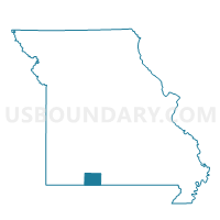
Outline

Summary
| Unique Area Identifier | 611472 |
| Name | PROTEM Voting District |
| County | Taney County |
| State | Missouri |
| Area (square miles) | 74.09 |
| Land Area (square miles) | 72.78 |
| Water Area (square miles) | 1.31 |
| % of Land Area | 98.24 |
| % of Water Area | 1.76 |
| Latitude of the Internal Point | 36.54881400 |
| Longtitude of the Internal Point | -92.85366560 |
Maps


Graphs
Select a template below for downloading or customizing gragh for PROTEM Voting District, Taney County, Missouri


Neighbors
Neighoring Voting District (by Name) Neighboring Voting District on the Map
- Big Creek Voting District, Ozark County, MO
- BROWN BRANCH Voting District, Taney County, MO
- BRYANT Voting District, Taney County, MO
- CEDARCREEK Voting District, Taney County, MO
- FRANKLIN Voting District, Marion County, AR
- KESSE Voting District, Marion County, AR
- Sugar Loaf Voting District, Boone County, AR
- Thornfield Voting District, Ozark County, MO
Top 10 Neighboring County Subdivision (by Population) Neighboring County Subdivision on the Map
- Marion County township, Marion County, AR (16,653)
- Sugar Loaf township, Boone County, AR (2,320)
- Big Creek township, Ozark County, MO (973)
- Beaver township, Taney County, MO (890)
- Big Creek township, Taney County, MO (572)
- Cedar Creek township, Taney County, MO (475)
- Longrun township, Ozark County, MO (76)
Top 10 Neighboring Elementary School District (by Population) Neighboring Elementary School District on the Map
Top 10 Neighboring Unified School District (by Population) Neighboring Unified School District on the Map
- Forsyth R-III School District, MO (8,646)
- Yellville-Summit School District, AR (6,259)
- Ozark Mountain School District, AR (5,101)
- Lead Hill School District, AR (2,824)
- Lutie R-VI School District, MO (1,635)
Top 10 Neighboring State Legislative District Lower Chamber (by Population) Neighboring State Legislative District Lower Chamber on the Map
Top 10 Neighboring State Legislative District Upper Chamber (by Population) Neighboring State Legislative District Upper Chamber on the Map
Top 10 Neighboring 111th Congressional District (by Population) Neighboring 111th Congressional District on the Map
Top 10 Neighboring Census Tract (by Population) Neighboring Census Tract on the Map
- Census Tract 7902, Boone County, AR (5,949)
- Census Tract 9603, Marion County, AR (5,178)
- Census Tract 4701, Ozark County, MO (4,819)
- Census Tract 4803.02, Taney County, MO (4,193)
- Census Tract 4804.02, Taney County, MO (2,495)