


Winona Voting District, Shannon County, Missouri
About
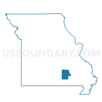
Outline

Summary
| Unique Area Identifier | 611382 |
| Name | Winona Voting District |
| County | Shannon County |
| State | Missouri |
| Area (square miles) | 137.31 |
| Land Area (square miles) | 137.27 |
| Water Area (square miles) | 0.04 |
| % of Land Area | 99.97 |
| % of Water Area | 0.03 |
| Latitude of the Internal Point | 37.00843970 |
| Longtitude of the Internal Point | -91.28860350 |
Maps


Graphs
Select a template below for downloading or customizing gragh for Winona Voting District, Shannon County, Missouri


Neighbors
Neighoring Voting District (by Name) Neighboring Voting District on the Map
- Bartlett Voting District, Shannon County, MO
- Delaware Voting District, Shannon County, MO
- Eminence Voting District, Shannon County, MO
- Fremont Voting District, Carter County, MO
- Moore & Blackpond Voting District, Oregon County, MO
- Van Buren Voting District, Carter County, MO
- Woodside Voting District, Oregon County, MO
Top 10 Neighboring County Subdivision (by Population) Neighboring County Subdivision on the Map
- Winona township, Shannon County, MO (2,451)
- Carter township, Carter County, MO (2,270)
- Eminence township, Shannon County, MO (1,773)
- Bartlett township, Shannon County, MO (443)
- Pike township, Carter County, MO (357)
- Woodside township, Oregon County, MO (279)
- Kelly township, Carter County, MO (232)
- Delaware township, Shannon County, MO (91)
- Falling Spring township, Oregon County, MO (31)
Top 10 Neighboring Place (by Population) Neighboring Place on the Map
Top 10 Neighboring Unified School District (by Population) Neighboring Unified School District on the Map
- Mountain View-Birch Tree R-III School District, MO (8,022)
- Alton R-IV School District, MO (4,750)
- Southern Reynolds County R-IV School District, MO (3,041)
- Van Buren R-I School District, MO (3,004)
- Winona R-III School District, MO (2,622)
- Eminence R-I School District, MO (2,029)
Top 10 Neighboring State Legislative District Lower Chamber (by Population) Neighboring State Legislative District Lower Chamber on the Map
Top 10 Neighboring State Legislative District Upper Chamber (by Population) Neighboring State Legislative District Upper Chamber on the Map
Top 10 Neighboring 111th Congressional District (by Population) Neighboring 111th Congressional District on the Map
Top 10 Neighboring Census Tract (by Population) Neighboring Census Tract on the Map
- Census Tract 4702, Shannon County, MO (5,048)
- Census Tract 4801, Oregon County, MO (3,749)
- Census Tract 4701, Shannon County, MO (3,393)
- Census Tract 9602, Carter County, MO (2,537)
Top 10 Neighboring 5-Digit ZIP Code Tabulation Area (by Population) Neighboring 5-Digit ZIP Code Tabulation Area on the Map
- 65438, MO (2,980)
- 63638, MO (2,920)
- 63965, MO (2,697)
- 65588, MO (2,680)
- 65466, MO (1,634)
- 63941, MO (371)