


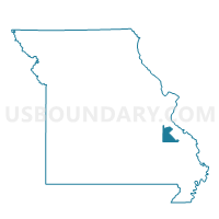
Timberline Voting District, St. Francois County, Missouri
About
Outline

Summary
| Unique Area Identifier | 609744 |
| Name | Timberline Voting District |
| County | St. Francois County |
| State | Missouri |
| Area (square miles) | 5.68 |
| Land Area (square miles) | 5.68 |
| Water Area (square miles) | 0.00 |
| % of Land Area | 100.00 |
| % of Water Area | 0.00 |
| Latitude of the Internal Point | 38.04273450 |
| Longtitude of the Internal Point | -90.62892170 |
Maps


Graphs
Select a template below for downloading or customizing gragh for Timberline Voting District, St. Francois County, Missouri


Neighbors
Neighoring Voting District (by Name) Neighboring Voting District on the Map
- Bonne Terre No. 2 Voting District, St. Francois County, MO
- Cadet Voting District, Washington County, MO
- Cruise Voting District, Washington County, MO
- Sunrise Voting District, Jefferson County, MO
- Vineland No. 1 Voting District, Jefferson County, MO
- Vineland No. 2 Voting District, Jefferson County, MO
Top 10 Neighboring County Subdivision (by Population) Neighboring County Subdivision on the Map
- Valle township, Jefferson County, MO (15,153)
- Union township, Washington County, MO (3,107)
- Big River township, St. Francois County, MO (2,015)
- Kingston township, Washington County, MO (1,553)
Top 10 Neighboring Elementary School District (by Population) Neighboring Elementary School District on the Map
Top 10 Neighboring Unified School District (by Population) Neighboring Unified School District on the Map
Top 10 Neighboring State Legislative District Lower Chamber (by Population) Neighboring State Legislative District Lower Chamber on the Map
- State House District 107, MO (40,428)
- State House District 110, MO (37,588)
- State House District 104, MO (35,833)
Top 10 Neighboring State Legislative District Upper Chamber (by Population) Neighboring State Legislative District Upper Chamber on the Map
Top 10 Neighboring 111th Congressional District (by Population) Neighboring 111th Congressional District on the Map
Top 10 Neighboring Census Tract (by Population) Neighboring Census Tract on the Map
- Census Tract 4601, Washington County, MO (6,525)
- Census Tract 9501.02, St. Francois County, MO (4,765)
- Census Tract 7014.01, Jefferson County, MO (3,918)