


Post Oak Voting District, Johnson County, Missouri
About
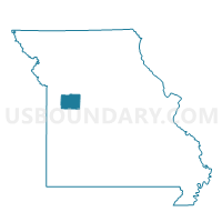
Outline

Summary
| Unique Area Identifier | 608884 |
| Name | Post Oak Voting District |
| County | Johnson County |
| State | Missouri |
| Area (square miles) | 70.04 |
| Land Area (square miles) | 69.89 |
| Water Area (square miles) | 0.16 |
| % of Land Area | 99.77 |
| % of Water Area | 0.23 |
| Latitude of the Internal Point | 38.62267350 |
| Longtitude of the Internal Point | -93.72647310 |
Maps


Graphs
Select a template below for downloading or customizing gragh for Post Oak Voting District, Johnson County, Missouri


Neighbors
Neighoring Voting District (by Name) Neighboring Voting District on the Map
- Chilhowee Voting District, Johnson County, MO
- Jefferson Voting District, Johnson County, MO
- Montserrat Voting District, Johnson County, MO
- Shawnee Voting District, Henry County, MO
- Springfield / Tebo Voting District, Henry County, MO
- Warrensburg Southeast No. 1 Voting District, Johnson County, MO
- Warrensburg Southwest Voting District, Johnson County, MO
Top 10 Neighboring County Subdivision (by Population) Neighboring County Subdivision on the Map
- Warrensburg township, Johnson County, MO (23,218)
- Post Oak township, Johnson County, MO (2,022)
- Montserrat township, Johnson County, MO (1,861)
- Chilhowee township, Johnson County, MO (1,140)
- Tebo township, Henry County, MO (844)
- Jefferson township, Johnson County, MO (737)
- Shawnee township, Henry County, MO (471)
Top 10 Neighboring Place (by Population) Neighboring Place on the Map
Top 10 Neighboring Elementary School District (by Population) Neighboring Elementary School District on the Map
Top 10 Neighboring Unified School District (by Population) Neighboring Unified School District on the Map
- Warrensburg R-VI School District, MO (25,863)
- Henry County R-I School District, MO (4,607)
- Leeton R-X School District, MO (1,883)
- Chilhowee R-IV School District, MO (1,053)
Top 10 Neighboring State Legislative District Lower Chamber (by Population) Neighboring State Legislative District Lower Chamber on the Map
Top 10 Neighboring State Legislative District Upper Chamber (by Population) Neighboring State Legislative District Upper Chamber on the Map
Top 10 Neighboring 111th Congressional District (by Population) Neighboring 111th Congressional District on the Map
Top 10 Neighboring Census Tract (by Population) Neighboring Census Tract on the Map
- Census Tract 9603, Johnson County, MO (8,910)
- Census Tract 9609, Johnson County, MO (4,939)
- Census Tract 9502, Henry County, MO (3,809)
- Census Tract 9503, Henry County, MO (3,286)