


Boone Voting District, Douglas County, Missouri
About
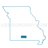
Outline

Summary
| Unique Area Identifier | 607739 |
| Name | Boone Voting District |
| County | Douglas County |
| State | Missouri |
| Area (square miles) | 36.40 |
| Land Area (square miles) | 36.40 |
| Water Area (square miles) | 0.01 |
| % of Land Area | 99.98 |
| % of Water Area | 0.02 |
| Latitude of the Internal Point | 36.94768550 |
| Longtitude of the Internal Point | -92.57685540 |
Maps


Graphs
Select a template below for downloading or customizing gragh for Boone Voting District, Douglas County, Missouri


Neighbors
Neighoring Voting District (by Name) Neighboring Voting District on the Map
- Benton No. 1 Voting District, Douglas County, MO
- Benton No. 2 Voting District, Douglas County, MO
- Brown Voting District, Douglas County, MO
- Clay Voting District, Douglas County, MO
- Findley Voting District, Douglas County, MO
- McMurtrey Voting District, Douglas County, MO
- Miller Voting District, Douglas County, MO
- Spring Creek Voting District, Douglas County, MO
- Walls Voting District, Douglas County, MO
Top 10 Neighboring County Subdivision (by Population) Neighboring County Subdivision on the Map
- Benton township, Douglas County, MO (4,308)
- Spring Creek township, Douglas County, MO (844)
- Miller township, Douglas County, MO (716)
- Findley township, Douglas County, MO (609)
- Boone township, Douglas County, MO (586)
- Walls township, Douglas County, MO (562)
- McMurtrey township, Douglas County, MO (431)
- Clay township, Douglas County, MO (305)
- Brown township, Douglas County, MO (236)
Top 10 Neighboring Elementary School District (by Population) Neighboring Elementary School District on the Map
Top 10 Neighboring Unified School District (by Population) Neighboring Unified School District on the Map
Top 10 Neighboring State Legislative District Lower Chamber (by Population) Neighboring State Legislative District Lower Chamber on the Map
Top 10 Neighboring State Legislative District Upper Chamber (by Population) Neighboring State Legislative District Upper Chamber on the Map
Top 10 Neighboring 111th Congressional District (by Population) Neighboring 111th Congressional District on the Map
Top 10 Neighboring Census Tract (by Population) Neighboring Census Tract on the Map
- Census Tract 9502, Douglas County, MO (5,580)
- Census Tract 9505, Douglas County, MO (4,383)
- Census Tract 9501, Douglas County, MO (3,721)