


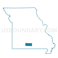
Clinton Voting District, Douglas County, Missouri
About
Outline

Summary
| Unique Area Identifier | 607736 |
| Name | Clinton Voting District |
| County | Douglas County |
| State | Missouri |
| Area (square miles) | 35.98 |
| Land Area (square miles) | 35.94 |
| Water Area (square miles) | 0.04 |
| % of Land Area | 99.90 |
| % of Water Area | 0.10 |
| Latitude of the Internal Point | 37.01556350 |
| Longtitude of the Internal Point | -92.14103330 |
Maps


Graphs
Select a template below for downloading or customizing gragh for Clinton Voting District, Douglas County, Missouri


Neighbors
Neighoring Voting District (by Name) Neighboring Voting District on the Map
- Bryan Voting District, Douglas County, MO
- Burdine Voting District, Texas County, MO
- Clinton Voting District, Texas County, MO
- McKinley Voting District, Douglas County, MO
- Willow Springs No. 1 Voting District, Howell County, MO
- Wood Voting District, Douglas County, MO
Top 10 Neighboring County Subdivision (by Population) Neighboring County Subdivision on the Map
- Willow Springs township, Howell County, MO (5,000)
- Burdine township, Texas County, MO (3,336)
- Clinton township, Texas County, MO (1,652)
- Wood township, Douglas County, MO (366)
- Bryan township, Douglas County, MO (346)
- Clinton township, Douglas County, MO (249)
- McKinley township, Douglas County, MO (204)
Top 10 Neighboring Unified School District (by Population) Neighboring Unified School District on the Map
Top 10 Neighboring State Legislative District Lower Chamber (by Population) Neighboring State Legislative District Lower Chamber on the Map
- State House District 147, MO (38,962)
- State House District 151, MO (37,152)
- State House District 144, MO (35,226)
Top 10 Neighboring State Legislative District Upper Chamber (by Population) Neighboring State Legislative District Upper Chamber on the Map
Top 10 Neighboring 111th Congressional District (by Population) Neighboring 111th Congressional District on the Map
Top 10 Neighboring Census Tract (by Population) Neighboring Census Tract on the Map
- Census Tract 4804, Texas County, MO (6,369)
- Census Tract 901, Howell County, MO (5,377)
- Census Tract 9501, Douglas County, MO (3,721)