


Jackson Voting District, Dallas County, Missouri
About
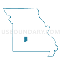
Outline

Summary
| Unique Area Identifier | 607693 |
| Name | Jackson Voting District |
| County | Dallas County |
| State | Missouri |
| Area (square miles) | 54.22 |
| Land Area (square miles) | 54.12 |
| Water Area (square miles) | 0.10 |
| % of Land Area | 99.81 |
| % of Water Area | 0.19 |
| Latitude of the Internal Point | 37.53647510 |
| Longtitude of the Internal Point | -93.09562980 |
Maps


Graphs
Select a template below for downloading or customizing gragh for Jackson Voting District, Dallas County, Missouri


Neighbors
Neighoring Voting District (by Name) Neighboring Voting District on the Map
- Benton South Voting District, Dallas County, MO
- Jackson Voting District, Webster County, MO
- Mooney Voting District, Polk County, MO
- Sheridan Voting District, Dallas County, MO
- South Benton Voting District, Polk County, MO
- Washington Voting District, Dallas County, MO
- Wilson Voting District, Dallas County, MO
Top 10 Neighboring County Subdivision (by Population) Neighboring County Subdivision on the Map
- Mooney township, Polk County, MO (3,252)
- South Benton township, Dallas County, MO (2,376)
- Jackson township, Dallas County, MO (2,207)
- Jackson township, Webster County, MO (1,549)
- Sheridan township, Dallas County, MO (1,530)
- Wilson township, Dallas County, MO (1,126)
- South Benton township, Polk County, MO (1,058)
- Washington township, Dallas County, MO (919)
Top 10 Neighboring Unified School District (by Population) Neighboring Unified School District on the Map
- Marshfield R-I School District, MO (16,818)
- Dallas County R-I School District, MO (12,874)
- Fair Grove R-10 School District, MO (5,671)
- Pleasant Hope R-VI School District, MO (4,888)
- Halfway R-III School District, MO (2,223)
Top 10 Neighboring State Legislative District Lower Chamber (by Population) Neighboring State Legislative District Lower Chamber on the Map
- State House District 145, MO (40,013)
- State House District 133, MO (37,830)
- State House District 126, MO (36,895)
- State House District 119, MO (36,209)
Top 10 Neighboring State Legislative District Upper Chamber (by Population) Neighboring State Legislative District Upper Chamber on the Map
Top 10 Neighboring 111th Congressional District (by Population) Neighboring 111th Congressional District on the Map
Top 10 Neighboring Census Tract (by Population) Neighboring Census Tract on the Map
- Census Tract 9603, Polk County, MO (8,438)
- Census Tract 4803, Dallas County, MO (6,855)
- Census Tract 4701.02, Webster County, MO (5,616)