


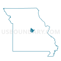
JC 3-3, Cole County, Missouri
About
Outline

Summary
| Unique Area Identifier | 607603 |
| Name | JC 3-3 |
| County | Cole County |
| State | Missouri |
| Area (square miles) | 1.47 |
| Land Area (square miles) | 1.47 |
| Water Area (square miles) | 0.00 |
| % of Land Area | 99.78 |
| % of Water Area | 0.22 |
| Latitude of the Internal Point | 38.60776330 |
| Longtitude of the Internal Point | -92.22538400 |
Maps


Graphs
Select a template below for downloading or customizing gragh for JC 3-3, Cole County, Missouri


Neighbors
Neighoring Voting District (by Name) Neighboring Voting District on the Map
- JC 3-2, Cole County, MO
- JC 3-4, Cole County, MO
- JC 3-5, Cole County, MO
- Scott Station Voting District, Cole County, MO