


Mantee Voting District, Webster County, Mississippi
About
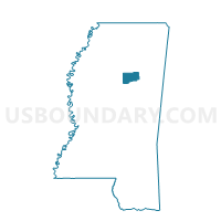
Outline

Summary
| Unique Area Identifier | 606918 |
| Name | Mantee Voting District |
| County | Webster County |
| State | Mississippi |
| Area (square miles) | 30.39 |
| Land Area (square miles) | 30.10 |
| Water Area (square miles) | 0.28 |
| % of Land Area | 99.08 |
| % of Water Area | 0.92 |
| Latitude of the Internal Point | 33.69530140 |
| Longtitude of the Internal Point | -89.09326660 |
Maps


Graphs
Select a template below for downloading or customizing gragh for Mantee Voting District, Webster County, Mississippi


Neighbors
Neighoring Voting District (by Name) Neighboring Voting District on the Map
- Clarkson Voting District, Webster County, MS
- Cumberland Voting District, Webster County, MS
- Derma 4 Voting District, Calhoun County, MS
- Fame Voting District, Webster County, MS
- Pheba Voting District, Clay County, MS
- Pine Bluff Voting District, Clay County, MS
- Sparta Voting District, Chickasaw County, MS
- Woodland Voting District, Chickasaw County, MS
Top 10 Neighboring County Subdivision (by Population) Neighboring County Subdivision on the Map
- District 5, Clay County, MS (3,847)
- District 2, Chickasaw County, MS (3,370)
- District 4, Calhoun County, MS (3,000)
- District 5, Webster County, MS (2,188)
Top 10 Neighboring Place (by Population) Neighboring Place on the Map
Top 10 Neighboring Unified School District (by Population) Neighboring Unified School District on the Map
- Calhoun County School District, MS (14,962)
- Webster County School District, MS (10,253)
- Houston School District, MS (9,902)
- Clay County School District, MS (2,543)
Top 10 Neighboring State Legislative District Lower Chamber (by Population) Neighboring State Legislative District Lower Chamber on the Map
- State House District 36, MS (21,886)
- State House District 23, MS (21,543)
- State House District 22, MS (21,435)
- State House District 35, MS (21,308)
Top 10 Neighboring State Legislative District Upper Chamber (by Population) Neighboring State Legislative District Upper Chamber on the Map
- State Senate District 15, MS (57,328)
- State Senate District 8, MS (52,845)
- State Senate District 16, MS (49,681)
Top 10 Neighboring 111th Congressional District (by Population) Neighboring 111th Congressional District on the Map
Top 10 Neighboring Census Tract (by Population) Neighboring Census Tract on the Map
- Census Tract 9504, Chickasaw County, MS (5,540)
- Census Tract 9501, Webster County, MS (4,543)
- Census Tract 9504, Calhoun County, MS (3,250)
- Census Tract 9502, Clay County, MS (2,537)