


Sunrise Voting District, Forrest County, Mississippi
About
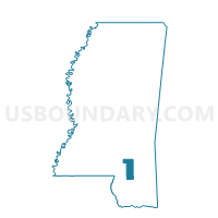
Outline

Summary
| Unique Area Identifier | 605343 |
| Name | Sunrise Voting District |
| County | Forrest County |
| State | Mississippi |
| Area (square miles) | 41.33 |
| Land Area (square miles) | 40.78 |
| Water Area (square miles) | 0.55 |
| % of Land Area | 98.67 |
| % of Water Area | 1.33 |
| Latitude of the Internal Point | 31.29101700 |
| Longtitude of the Internal Point | -89.18984950 |
Maps


Graphs
Select a template below for downloading or customizing gragh for Sunrise Voting District, Forrest County, Mississippi


Neighbors
Neighoring Voting District (by Name) Neighboring Voting District on the Map
- Barrontown-Macedonia Voting District, Forrest County, MS
- Dixie Pine-Central Voting District, Forrest County, MS
- East Petal Voting District, Forrest County, MS
- Indian Springs Voting District, Perry County, MS
- N.A. Courthouse Voting District, Perry County, MS
- Petal Masonic Lodge Voting District, Forrest County, MS
- Runnelstown Voting District, Perry County, MS
Top 10 Neighboring County Subdivision (by Population) Neighboring County Subdivision on the Map
- District 3, Forrest County, MS (17,789)
- District 4, Forrest County, MS (14,114)
- District 2, Perry County, MS (2,836)
- District 5, Perry County, MS (2,443)
- District 1, Perry County, MS (2,130)
Top 10 Neighboring Place (by Population) Neighboring Place on the Map
Top 10 Neighboring Unified School District (by Population) Neighboring Unified School District on the Map
- Petal School District, MS (19,483)
- Forrest County Schools, MS (19,408)
- Perry County Schools, MS (8,511)
Top 10 Neighboring State Legislative District Lower Chamber (by Population) Neighboring State Legislative District Lower Chamber on the Map
- State House District 104, MS (28,940)
- State House District 103, MS (25,555)
- State House District 88, MS (25,071)
- State House District 105, MS (24,574)
Top 10 Neighboring State Legislative District Upper Chamber (by Population) Neighboring State Legislative District Upper Chamber on the Map
- State Senate District 44, MS (71,264)
- State Senate District 45, MS (57,871)
- State Senate District 41, MS (56,638)
Top 10 Neighboring 111th Congressional District (by Population) Neighboring 111th Congressional District on the Map
Top 10 Neighboring Census Tract (by Population) Neighboring Census Tract on the Map
- Census Tract 106, Forrest County, MS (8,006)
- Census Tract 101.02, Forrest County, MS (6,153)
- Census Tract 101.01, Forrest County, MS (5,622)
- Census Tract 105, Forrest County, MS (4,232)
- Census Tract 104, Forrest County, MS (4,198)
- Census Tract 9501.02, Perry County, MS (3,877)
- Census Tract 9502, Perry County, MS (3,672)
- Census Tract 103, Forrest County, MS (3,510)