


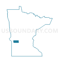
Danvers Voting District, Swift County, Minnesota
About
Outline

Summary
| Unique Area Identifier | 604606 |
| Name | Danvers Voting District |
| County | Swift County |
| State | Minnesota |
| Area (square miles) | 0.74 |
| Land Area (square miles) | 0.74 |
| Water Area (square miles) | 0.00 |
| % of Land Area | 100.00 |
| % of Water Area | 0.00 |
| Latitude of the Internal Point | 45.28090550 |
| Longtitude of the Internal Point | -95.75575830 |
Maps


Graphs
Select a template below for downloading or customizing gragh for Danvers Voting District, Swift County, Minnesota


Neighbors
Neighoring Voting District (by Name) Neighboring Voting District on the Map
- Marysland Twp. Voting District, Swift County, MN
- Six Mile Grove Twp. Voting District, Swift County, MN
Top 10 Neighboring County Subdivision (by Population) Neighboring County Subdivision on the Map
- Six Mile Grove township, Swift County, MN (171)
- Danvers city, Swift County, MN (97)
- Marysland township, Swift County, MN (96)