


Morris W-2 P-A, Stevens County, Minnesota
About
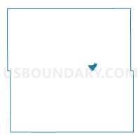
Outline

Summary
| Unique Area Identifier | 604591 |
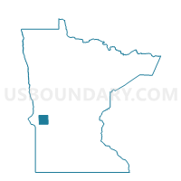
| Name | Morris W-2 P-A |
| County | Stevens County |
| State | Minnesota |
| Area (square miles) | 1.08 |
| Land Area (square miles) | 1.08 |
| Water Area (square miles) | 0.00 |
| % of Land Area | 100.00 |
| % of Water Area | 0.00 |
| Latitude of the Internal Point | 45.59589740 |
| Longtitude of the Internal Point | -95.91066630 |
Maps

Graphs
Select a template below for downloading or customizing gragh for Morris W-2 P-A, Stevens County, Minnesota


Neighbors
Neighoring Voting District (by Name) Neighboring Voting District on the Map
- Morris Twp. Voting District, Stevens County, MN
- Morris W-1 P-A, Stevens County, MN
- Morris W-1 P-B, Stevens County, MN
- Morris W-2 P-B, Stevens County, MN
- Morris W-3 P-A, Stevens County, MN