


Fergus Falls W-2 P-2, Otter Tail County, Minnesota
About
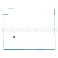
Outline

Summary
| Unique Area Identifier | 603549 |
| Name | Fergus Falls W-2 P-2 |
| County | Otter Tail County |
| State | Minnesota |
| Area (square miles) | 3.03 |
| Land Area (square miles) | 2.59 |
| Water Area (square miles) | 0.44 |
| % of Land Area | 85.62 |
| % of Water Area | 14.38 |
| Latitude of the Internal Point | 46.29526160 |
| Longtitude of the Internal Point | -96.03843470 |
Maps


Graphs
Select a template below for downloading or customizing gragh for Fergus Falls W-2 P-2, Otter Tail County, Minnesota


Neighbors
Neighoring Voting District (by Name) Neighboring Voting District on the Map
- Aurdal Twp. Voting District, Otter Tail County, MN
- Buse Twp. Voting District, Otter Tail County, MN
- Fergus Falls Twp. Voting District, Otter Tail County, MN
- Fergus Falls W-1 P-1, Otter Tail County, MN
- Fergus Falls W-2 P-1, Otter Tail County, MN
Top 10 Neighboring County Subdivision (by Population) Neighboring County Subdivision on the Map
- Fergus Falls city, Otter Tail County, MN (13,138)
- Aurdal township, Otter Tail County, MN (1,450)
- Fergus Falls township, Otter Tail County, MN (1,006)
- Buse township, Otter Tail County, MN (491)