


Tumuli Twp. Voting District, Otter Tail County, Minnesota
About
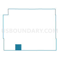
Outline

Summary
| Unique Area Identifier | 603536 |
| Name | Tumuli Twp. Voting District |
| County | Otter Tail County |
| State | Minnesota |
| Area (square miles) | 35.50 |
| Land Area (square miles) | 28.81 |
| Water Area (square miles) | 6.69 |
| % of Land Area | 81.16 |
| % of Water Area | 18.84 |
| Latitude of the Internal Point | 46.14946230 |
| Longtitude of the Internal Point | -95.94894850 |
Maps


Graphs
Select a template below for downloading or customizing gragh for Tumuli Twp. Voting District, Otter Tail County, Minnesota


Neighbors
Neighoring Voting District (by Name) Neighboring Voting District on the Map
- Aastad Twp. Voting District, Otter Tail County, MN
- Buse Twp. Voting District, Otter Tail County, MN
- Dalton Voting District, Otter Tail County, MN
- Dane Prairie Twp. Voting District, Otter Tail County, MN
- Pelican Lake Twp. Voting District, Grant County, MN
- Pomme De Terre Twp. Voting District, Grant County, MN
- St Olaf Twp. Voting District, Otter Tail County, MN
- Stony Brook Twp. Voting District, Grant County, MN
- Tordenskjold Twp. Voting District, Otter Tail County, MN
Top 10 Neighboring County Subdivision (by Population) Neighboring County Subdivision on the Map
- Dane Prairie township, Otter Tail County, MN (887)
- Tordenskjold township, Otter Tail County, MN (551)
- Buse township, Otter Tail County, MN (491)
- Pelican Lake township, Grant County, MN (450)
- Tumuli township, Otter Tail County, MN (449)
- St. Olaf township, Otter Tail County, MN (352)
- Dalton city, Otter Tail County, MN (253)
- Aastad township, Otter Tail County, MN (213)
- Pomme de Terre township, Grant County, MN (133)
- Stony Brook township, Grant County, MN (133)
Top 10 Neighboring Place (by Population) Neighboring Place on the Map
Top 10 Neighboring Unified School District (by Population) Neighboring Unified School District on the Map
- Fergus Falls Public School District, MN (19,386)
- West Central Area Schools, MN (5,165)
- Underwood Public School District, MN (2,371)
- Ashby Public School District, MN (1,413)
Top 10 Neighboring State Legislative District Lower Chamber (by Population) Neighboring State Legislative District Lower Chamber on the Map
Top 10 Neighboring State Legislative District Upper Chamber (by Population) Neighboring State Legislative District Upper Chamber on the Map
Top 10 Neighboring 111th Congressional District (by Population) Neighboring 111th Congressional District on the Map
Top 10 Neighboring Census Tract (by Population) Neighboring Census Tract on the Map
- Census Tract 9617, Otter Tail County, MN (3,267)
- Census Tract 701, Grant County, MN (3,092)
- Census Tract 9616, Otter Tail County, MN (2,285)