


Bridgie Precinct, Koochiching County, Minnesota
About
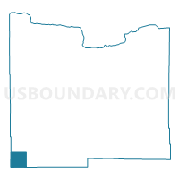
Outline

Summary
| Unique Area Identifier | 602792 |
| Name | Bridgie Precinct |
| County | Koochiching County |
| State | Minnesota |
| Area (square miles) | 35.97 |
| Land Area (square miles) | 35.48 |
| Water Area (square miles) | 0.50 |
| % of Land Area | 98.62 |
| % of Water Area | 1.38 |
| Latitude of the Internal Point | 47.89755390 |
| Longtitude of the Internal Point | -94.36601730 |
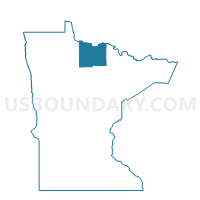
Maps

Graphs
Select a template below for downloading or customizing gragh for Bridgie Precinct, Koochiching County, Minnesota


Neighbors
Neighoring Voting District (by Name) Neighboring Voting District on the Map
- Ardenhurst Twp. Voting District, Itasca County, MN
- Englewood-Pinetop Precinct, Koochiching County, MN
- Forest Grove Precinct, Koochiching County, MN
- Hornet Twp. Voting District, Beltrami County, MN
- Nore Twp. Voting District, Itasca County, MN
- Northome Voting District, Koochiching County, MN
- Shooks Twp. Voting District, Beltrami County, MN
Top 10 Neighboring County Subdivision (by Population) Neighboring County Subdivision on the Map
- Northome UT, Koochiching County, MN (447)
- Hornet township, Beltrami County, MN (232)
- Northome city, Koochiching County, MN (200)
- Shooks township, Beltrami County, MN (189)
- Ardenhurst township, Itasca County, MN (164)
- Nore township, Itasca County, MN (57)
Top 10 Neighboring Place (by Population) Neighboring Place on the Map
Top 10 Neighboring Unified School District (by Population) Neighboring Unified School District on the Map
- Grand Rapids Public School District, MN (27,545)
- Blackduck Public School District, MN (3,971)
- South Koochiching School District, MN (1,317)
- Kelliher Public School District, MN (1,022)
Top 10 Neighboring State Legislative District Lower Chamber (by Population) Neighboring State Legislative District Lower Chamber on the Map
Top 10 Neighboring State Legislative District Upper Chamber (by Population) Neighboring State Legislative District Upper Chamber on the Map
Top 10 Neighboring 111th Congressional District (by Population) Neighboring 111th Congressional District on the Map
Top 10 Neighboring Census Tract (by Population) Neighboring Census Tract on the Map
- Census Tract 4801, Itasca County, MN (2,649)
- Census Tract 7905, Koochiching County, MN (2,419)
- Census Tract 4505, Beltrami County, MN (1,715)