


Baxter P-1W, Crow Wing County, Minnesota
About
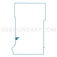
Outline

Summary
| Unique Area Identifier | 601696 |
| Name | Baxter P-1W |
| County | Crow Wing County |
| State | Minnesota |
| Area (square miles) | 3.93 |
| Land Area (square miles) | 3.30 |
| Water Area (square miles) | 0.62 |
| % of Land Area | 84.10 |
| % of Water Area | 15.90 |
| Latitude of the Internal Point | 46.36454280 |
| Longtitude of the Internal Point | -94.30116930 |
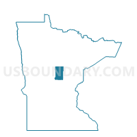
Maps

Graphs
Select a template below for downloading or customizing gragh for Baxter P-1W, Crow Wing County, Minnesota


Neighbors
Neighoring Voting District (by Name) Neighboring Voting District on the Map
- Baxter P-1E, Crow Wing County, MN
- Baxter P-2W, Crow Wing County, MN
- East Gull Lake Voting District, Cass County, MN
- Sylvan Twp. Voting District, Cass County, MN
- White Prec., Crow Wing County, MN
Top 10 Neighboring County Subdivision (by Population) Neighboring County Subdivision on the Map
- Baxter city, Crow Wing County, MN (7,610)
- First Assessment UT, Crow Wing County, MN (5,424)
- Sylvan township, Cass County, MN (2,702)
- East Gull Lake city, Cass County, MN (1,004)