


Maple Hill Prec. 8, Cook County, Minnesota
About
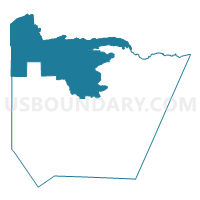
Outline

Summary
| Unique Area Identifier | 601598 |
| Name | Maple Hill Prec. 8 |
| County | Cook County |
| State | Minnesota |
| Area (square miles) | 728.98 |
| Land Area (square miles) | 615.89 |
| Water Area (square miles) | 113.08 |
| % of Land Area | 84.49 |
| % of Water Area | 15.51 |
| Latitude of the Internal Point | 48.00059610 |
| Longtitude of the Internal Point | -90.59781290 |
Maps


Graphs
Select a template below for downloading or customizing gragh for Maple Hill Prec. 8, Cook County, Minnesota


Neighbors
Neighoring Voting District (by Name) Neighboring Voting District on the Map
- Cascade Prec. 7, Cook County, MN
- Colvill Prec. 3, Cook County, MN
- Croftville Prec. 4, Cook County, MN
- Fall Lake Twp. Voting District, Lake County, MN
- Grand Marais East Prec. 5, Cook County, MN
- Grand Marais West Prec. 6, Cook County, MN
- Hovland Prec. 2, Cook County, MN
- Lutsen Prec. 10, Cook County, MN
- Pike Lake Prec. 9, Cook County, MN
- Schroeder Twp. Prec. 12, Cook County, MN
- Tofte Twp. Prec. 11, Cook County, MN
- Unorg. Terr. No. 1 Voting District, Lake County, MN
Top 10 Neighboring County Subdivision (by Population) Neighboring County Subdivision on the Map
- West Cook UT, Cook County, MN (1,616)
- Grand Marais city, Cook County, MN (1,351)
- East Cook UT, Cook County, MN (775)
- Fall Lake township, Lake County, MN (549)
- Lutsen township, Cook County, MN (415)
- Tofte township, Cook County, MN (249)
- Schroeder township, Cook County, MN (205)
- Lake No. 1 UT, Lake County, MN (154)
Top 10 Neighboring Place (by Population) Neighboring Place on the Map
Top 10 Neighboring Unified School District (by Population) Neighboring Unified School District on the Map
Top 10 Neighboring State Legislative District Lower Chamber (by Population) Neighboring State Legislative District Lower Chamber on the Map
Top 10 Neighboring State Legislative District Upper Chamber (by Population) Neighboring State Legislative District Upper Chamber on the Map
Top 10 Neighboring 111th Congressional District (by Population) Neighboring 111th Congressional District on the Map
Top 10 Neighboring Census Tract (by Population) Neighboring Census Tract on the Map
- Census Tract 3701, Lake County, MN (4,471)
- Census Tract 4801, Cook County, MN (3,126)
- Census Tract 4802, Cook County, MN (2,050)