


Ogema Voting District, Becker County, Minnesota
About
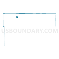
Outline

Summary
| Unique Area Identifier | 601111 |
| Name | Ogema Voting District |
| County | Becker County |
| State | Minnesota |
| Area (square miles) | 1.28 |
| Land Area (square miles) | 1.23 |
| Water Area (square miles) | 0.06 |
| % of Land Area | 95.69 |
| % of Water Area | 4.31 |
| Latitude of the Internal Point | 47.10191730 |
| Longtitude of the Internal Point | -95.91538000 |
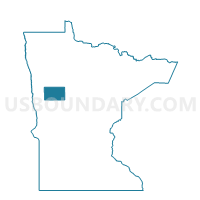
Maps

Graphs
Select a template below for downloading or customizing gragh for Ogema Voting District, Becker County, Minnesota


Neighbors
Neighoring Voting District (by Name) Neighboring Voting District on the Map
- Spring Creek Twp. Voting District, Becker County, MN
- White Earth Twp. Voting District, Becker County, MN
Top 10 Neighboring County Subdivision (by Population) Neighboring County Subdivision on the Map
- White Earth township, Becker County, MN (828)
- Ogema city, Becker County, MN (184)
- Spring Creek township, Becker County, MN (114)