


Voting District 1635294000002, Wayne County, Michigan
About
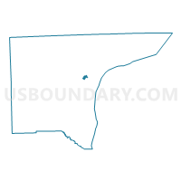
Outline

Summary
| Unique Area Identifier | 600319 |
| Name | Voting District 1635294000002 |
| County | Wayne County |
| State | Michigan |
| Area (square miles) | 0.53 |
| Land Area (square miles) | 0.49 |
| Water Area (square miles) | 0.04 |
| % of Land Area | 92.82 |
| % of Water Area | 7.18 |
| Latitude of the Internal Point | 42.29138570 |
| Longtitude of the Internal Point | -83.18037400 |
Maps


Graphs
Select a template below for downloading or customizing gragh for Voting District 1635294000002, Wayne County, Michigan


Neighbors
Neighoring Voting District (by Name) Neighboring Voting District on the Map
- Voting District 1630138000001, Wayne County, MI
- Voting District 1632100000021, Wayne County, MI
- Voting District 1632100000022, Wayne County, MI
- Voting District 1632200026009, Wayne County, MI
- Voting District 1635294000001, Wayne County, MI
- Voting District 1635294000003, Wayne County, MI
- Voting District 1635294000005, Wayne County, MI
Top 10 Neighboring County Subdivision (by Population) Neighboring County Subdivision on the Map
- Detroit city, Wayne County, MI (713,777)
- Dearborn city, Wayne County, MI (98,153)
- Allen Park city, Wayne County, MI (28,210)
- Melvindale city, Wayne County, MI (10,715)
Top 10 Neighboring Place (by Population) Neighboring Place on the Map
- Detroit city, MI (713,777)
- Dearborn city, MI (98,153)
- Allen Park city, MI (28,210)
- Melvindale city, MI (10,715)
Top 10 Neighboring Unified School District (by Population) Neighboring Unified School District on the Map
- Detroit City School District, MI (713,865)
- Dearborn City School District, MI (106,337)
- Melvindale-North Allen Park School District, MI (17,020)
Top 10 Neighboring State Legislative District Lower Chamber (by Population) Neighboring State Legislative District Lower Chamber on the Map
- State House District 15, MI (89,065)
- State House District 14, MI (86,443)
- State House District 16, MI (84,171)
- State House District 12, MI (73,576)
Top 10 Neighboring State Legislative District Upper Chamber (by Population) Neighboring State Legislative District Upper Chamber on the Map
Top 10 Neighboring 111th Congressional District (by Population) Neighboring 111th Congressional District on the Map
Top 10 Neighboring Census Tract (by Population) Neighboring Census Tract on the Map
- Census Tract 5785, Wayne County, MI (5,153)
- Census Tract 5760, Wayne County, MI (1,845)
- Census Tract 5245, Wayne County, MI (1,264)
- Census Tract 9857, Wayne County, MI (0)