


Voting Districts not defined, Monroe County, Michigan
About
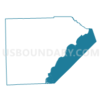
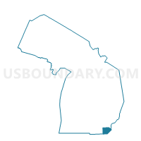
Outline

Summary
| Unique Area Identifier | 598371 |
| Name | Voting Districts not defined |
| County | Monroe County |
| State | Michigan |
| Area (square miles) | 118.70 |
| Land Area (square miles) | 0.00 |
| Water Area (square miles) | 118.69 |
| % of Land Area | 0.00 |
| % of Water Area | 100.00 |
| Latitude of the Internal Point | 41.76657970 |
| Longtitude of the Internal Point | -83.44633090 |
Maps

Graphs
Select a template below for downloading or customizing gragh for Voting Districts not defined, Monroe County, Michigan


Neighbors
Neighoring Voting District (by Name) Neighboring Voting District on the Map
- Voting District 1150772000001, Monroe County, MI
- Voting District 1150772000003, Monroe County, MI
- Voting District 1152632000001, Monroe County, MI
- Voting District 1153082000002, Monroe County, MI
- Voting District 1153082000003, Monroe County, MI
- Voting District 1153082000006, Monroe County, MI
- Voting District 1153082000008, Monroe County, MI
- Voting District 1154626000001, Monroe County, MI
- Voting District 1154970000001, Monroe County, MI
- Voting District 1155502000003N, Monroe County, MI
- Voting District 1155502000003S, Monroe County, MI
- Voting District 1155504000003, Monroe County, MI
- TOLEDO 1A Voting District, Lucas County, OH
- TOLEDO 1B Voting District, Lucas County, OH
- WASHINGTON 2 Voting District, Lucas County, OH
- WASHINGTON 4 Voting District, Lucas County, OH
- Water, Lucas County, OH
- Voting Districts not defined, Wayne County, MI
Top 10 Neighboring County Subdivision (by Population) Neighboring County Subdivision on the Map
- Toledo city, Lucas County, OH (287,208)
- Brownstown charter township, Wayne County, MI (30,627)
- Monroe city, Monroe County, MI (20,733)
- Frenchtown township, Monroe County, MI (20,428)
- Monroe charter township, Monroe County, MI (14,568)
- Berlin charter township, Monroe County, MI (9,299)
- La Salle township, Monroe County, MI (4,894)
- Erie township, Monroe County, MI (4,517)
- Washington township, Lucas County, OH (3,278)
- Jerusalem township, Lucas County, OH (3,109)
Top 10 Neighboring Place (by Population) Neighboring Place on the Map
- Toledo city, OH (287,208)
- Monroe city, MI (20,733)
- Detroit Beach CDP, MI (2,087)
- Woodland Beach CDP, MI (2,049)
- Stony Point CDP, MI (1,724)
- Luna Pier city, MI (1,436)
- Estral Beach village, MI (418)
Top 10 Neighboring Unified School District (by Population) Neighboring Unified School District on the Map
- Toledo City School District, OH (232,776)
- Monroe Public Schools, MI (48,896)
- Washington Local School District, OH (47,382)
- Gibraltar School District, MI (21,679)
- Jefferson Schools, MI (12,789)
- Mason Consolidated Schools, MI (7,859)
- School District Not Defined (Water), MI (243)
- School District Not Defined (Water), OH (4)
Top 10 Neighboring State Legislative District Lower Chamber (by Population) Neighboring State Legislative District Lower Chamber on the Map
- State House District 49, OH (107,325)
- State House District 55, MI (104,306)
- State House District 23, MI (97,124)
- State House District 56, MI (96,937)
- State House Districts not defined, OH (0)
Top 10 Neighboring State Legislative District Upper Chamber (by Population) Neighboring State Legislative District Upper Chamber on the Map
- State Senate District 11, OH (314,125)
- State Senate District 7, MI (306,854)
- State Senate District 17, MI (267,269)
- State Senate Districts not defined, OH (0)
Top 10 Neighboring 111th Congressional District (by Population) Neighboring 111th Congressional District on the Map
Top 10 Neighboring Census Tract (by Population) Neighboring Census Tract on the Map
- Census Tract 8312, Monroe County, MI (6,611)
- Census Tract 8302, Monroe County, MI (5,759)
- Census Tract 56, Lucas County, OH (5,412)
- Census Tract 8313, Monroe County, MI (5,296)
- Census Tract 8325, Monroe County, MI (4,715)
- Census Tract 8317, Monroe County, MI (4,057)
- Census Tract 8301, Monroe County, MI (3,540)
- Census Tract 55.01, Lucas County, OH (3,018)
- Census Tract 8337, Monroe County, MI (2,697)
- Census Tract 8326, Monroe County, MI (2,204)
Top 10 Neighboring 5-Digit ZIP Code Tabulation Area (by Population) Neighboring 5-Digit ZIP Code Tabulation Area on the Map
- 48162, MI (29,344)
- 48161, MI (26,470)
- 43611, OH (19,207)
- 48166, MI (11,569)
- 48133, MI (5,753)
- 48145, MI (3,503)
- 48179, MI (3,274)
- 48157, MI (1,436)