


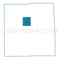
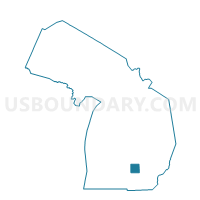
Voting District 0650080000003, Ingham County, Michigan
About
Outline

Summary
| Unique Area Identifier | 596936 |
| Name | Voting District 0650080000003 |
| County | Ingham County |
| State | Michigan |
| Area (square miles) | 13.81 |
| Land Area (square miles) | 13.75 |
| Water Area (square miles) | 0.06 |
| % of Land Area | 99.57 |
| % of Water Area | 0.43 |
| Latitude of the Internal Point | 42.65015000 |
| Longtitude of the Internal Point | -84.38937040 |
Maps

Graphs
Select a template below for downloading or customizing gragh for Voting District 0650080000003, Ingham County, Michigan


Neighbors
Neighoring Voting District (by Name) Neighboring Voting District on the Map
- Voting District 0650080000001, Ingham County, MI
- Voting District 0650080000002, Ingham County, MI
- Voting District 0654600002008, Ingham County, MI
- Voting District 0655314000007, Ingham County, MI
- Voting District 0655314000014, Ingham County, MI
- Voting District 0655314000016, Ingham County, MI
- Voting District 0658652000001, Ingham County, MI
Top 10 Neighboring County Subdivision (by Population) Neighboring County Subdivision on the Map
- Lansing city, Ingham County, MI (109,563)
- Meridian charter township, Ingham County, MI (39,688)
- Alaiedon township, Ingham County, MI (2,894)
- Wheatfield township, Ingham County, MI (1,632)
Top 10 Neighboring Place (by Population) Neighboring Place on the Map
Top 10 Neighboring Unified School District (by Population) Neighboring Unified School District on the Map
- Okemos Public Schools, MI (23,510)
- Mason Public Schools, MI (18,863)
- Williamston Community Schools, MI (10,212)
Top 10 Neighboring State Legislative District Lower Chamber (by Population) Neighboring State Legislative District Lower Chamber on the Map
Top 10 Neighboring State Legislative District Upper Chamber (by Population) Neighboring State Legislative District Upper Chamber on the Map
Top 10 Neighboring 111th Congressional District (by Population) Neighboring 111th Congressional District on the Map
Top 10 Neighboring Census Tract (by Population) Neighboring Census Tract on the Map
- Census Tract 50.01, Ingham County, MI (6,387)
- Census Tract 57, Ingham County, MI (4,878)
- Census Tract 50.02, Ingham County, MI (3,882)
- Census Tract 56, Ingham County, MI (2,892)