


Voting Districts not defined, Charlevoix County, Michigan
About
Outline
Summary
| Unique Area Identifier | 596200 |
| Name | Voting Districts not defined |
| County | Charlevoix County |
| State | Michigan |
| Area (square miles) | 1,011.11 |
| Land Area (square miles) | 72.69 |
| Water Area (square miles) | 938.41 |
| % of Land Area | 7.19 |
| % of Water Area | 92.81 |
| Latitude of the Internal Point | 45.60067360 |
| Longtitude of the Internal Point | -85.51099900 |
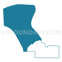
Maps


Graphs
Select a template below for downloading or customizing gragh for Voting Districts not defined, Charlevoix County, Michigan


Neighbors
Neighoring Voting District (by Name) Neighboring Voting District on the Map
- Voting District 0090524000001, Antrim County, MI
- Voting District 0291478001000, Charlevoix County, MI
- Voting District 0291480000004, Charlevoix County, MI
- Voting District 0293732000007, Charlevoix County, MI
- Voting District 0295934000011, Charlevoix County, MI
- Voting District 0476382000003, Emmet County, MI
- Voting Districts not defined, Leelanau County, MI
- Voting Districts not defined, Mackinac County, MI
- Voting Districts not defined, Schoolcraft County, MI
- Voting Districts not defined, Antrim County, MI
- Voting Districts not defined, Emmet County, MI
Top 10 Neighboring County Subdivision (by Population) Neighboring County Subdivision on the Map
- Petoskey city, Emmet County, MI (5,670)
- Charlevoix city, Charlevoix County, MI (2,513)
- Hayes township, Charlevoix County, MI (1,919)
- Charlevoix township, Charlevoix County, MI (1,645)
- Banks township, Antrim County, MI (1,609)
- Norwood township, Charlevoix County, MI (723)
- St. James township, Charlevoix County, MI (365)
- Peaine township, Charlevoix County, MI (292)
- County subdivisions not defined, Antrim County, MI (0)
- County subdivisions not defined, Emmet County, MI (0)
Top 10 Neighboring Place (by Population) Neighboring Place on the Map
- Petoskey city, MI (5,670)
- Charlevoix city, MI (2,513)
- Bay Shore CDP, MI (754)
- St. James CDP, MI (205)
- Norwood CDP, MI (142)
Top 10 Neighboring Unified School District (by Population) Neighboring Unified School District on the Map
- Petoskey Public Schools, MI (18,391)
- Charlevoix Public Schools, MI (8,573)
- Manistique Area Schools, MI (7,611)
- Northport Public School District, MI (2,000)
- Engadine Consolidated Schools, MI (1,955)
- Beaver Island Community School, MI (657)
- School District Not Defined (Water), MI (243)
Top 10 Neighboring State Legislative District Lower Chamber (by Population) Neighboring State Legislative District Lower Chamber on the Map
- State House District 105, MI (95,524)
- State House District 101, MI (92,671)
- State House District 109, MI (90,978)
- State House District 107, MI (86,648)
Top 10 Neighboring State Legislative District Upper Chamber (by Population) Neighboring State Legislative District Upper Chamber on the Map
- State Senate District 35, MI (261,943)
- State Senate District 38, MI (261,728)
- State Senate District 37, MI (258,370)
Top 10 Neighboring 111th Congressional District (by Population) Neighboring 111th Congressional District on the Map
Top 10 Neighboring Census Tract (by Population) Neighboring Census Tract on the Map
- Census Tract 9708, Emmet County, MI (3,933)
- Census Tract 8, Charlevoix County, MI (2,928)
- Census Tract 4, Charlevoix County, MI (2,762)
- Census Tract 9601, Antrim County, MI (2,602)
- Census Tract 5, Charlevoix County, MI (657)
- Census Tract 9900, Emmet County, MI (0)
- Census Tract 9900, Schoolcraft County, MI (0)
- Census Tract 9900, Antrim County, MI (0)
- Census Tract 9900, Leelanau County, MI (0)
- Census Tract 9900, Mackinac County, MI (0)