


Voting Districts not defined, Berrien County, Michigan
About
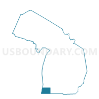
Outline

Summary
| Unique Area Identifier | 596047 |
| Name | Voting Districts not defined |
| County | Berrien County |
| State | Michigan |
| Area (square miles) | 1,001.19 |
| Land Area (square miles) | 0.00 |
| Water Area (square miles) | 1,001.19 |
| % of Land Area | 0.00 |
| % of Water Area | 100.00 |
| Latitude of the Internal Point | 42.01945160 |
| Longtitude of the Internal Point | -86.84388190 |
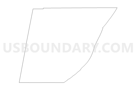
Maps


Graphs
Select a template below for downloading or customizing gragh for Voting Districts not defined, Berrien County, Michigan


Neighbors
Neighoring Voting District (by Name) Neighboring Voting District on the Map
- Voting District 0210740000004, Berrien County, MI
- Voting District 0210752000004, Berrien County, MI
- Voting District 0211058000001, Berrien County, MI
- Voting District 0211548000001, Berrien County, MI
- Voting District 0211548000002, Berrien County, MI
- Voting District 0213586000001, Berrien County, MI
- Voting District 0213586000002, Berrien County, MI
- Voting District 0214426000001, Berrien County, MI
- Voting District 0214760000003, Berrien County, MI
- Voting District 0214760000004, Berrien County, MI
- Voting District 0215722000001, Berrien County, MI
- Voting District 0215723000001, Berrien County, MI
- Voting District 0217096000001, Berrien County, MI
- Voting District 0217096000005, Berrien County, MI
- Voting District 0217098000002, Berrien County, MI
- Voting District 1591856000002, Van Buren County, MI
- HYDROLOGY - LAKE MICHIGAN, LaPorte County, IN
- Lake Michigan Voting District, Cook County, IL
- LAKE MICHIGAN, Lake County, IL
- LAKE MICHIGAN NV, Porter County, IN
- MICHIANA SHORES, LaPorte County, IN
- Voting Districts not defined, Van Buren County, MI
Top 10 Neighboring County Subdivision (by Population) Neighboring County Subdivision on the Map
- Michigan township, LaPorte County, IN (27,522)
- Benton charter township, Berrien County, MI (14,749)
- Lincoln charter township, Berrien County, MI (14,691)
- Benton Harbor city, Berrien County, MI (10,038)
- St. Joseph charter township, Berrien County, MI (10,028)
- St. Joseph city, Berrien County, MI (8,365)
- Hagar township, Berrien County, MI (3,671)
- Chikaming township, Berrien County, MI (3,100)
- Lake charter township, Berrien County, MI (2,972)
- Covert township, Van Buren County, MI (2,888)
Top 10 Neighboring Place (by Population) Neighboring Place on the Map
- Benton Harbor city, MI (10,038)
- St. Joseph city, MI (8,365)
- Bridgman city, MI (2,291)
- New Buffalo city, MI (1,883)
- Shorewood-Tower Hills-Harbert CDP, MI (1,344)
- Lake Michigan Beach CDP, MI (1,216)
- Long Beach town, IN (1,179)
- Shoreham village, MI (862)
- Grand Beach village, MI (272)
- Michiana village, MI (182)
Top 10 Neighboring Unified School District (by Population) Neighboring Unified School District on the Map
- Michigan City Area Schools, IN (48,411)
- Benton Harbor Area Schools, MI (30,693)
- St. Joseph Public Schools, MI (19,355)
- Lakeshore School District, MI (17,686)
- Coloma Community Schools, MI (9,664)
- River Valley School District, MI (7,693)
- Bridgman Public Schools, MI (4,919)
- New Buffalo Area School District, MI (4,503)
- Covert Public Schools, MI (3,119)
- School District Not Defined (Water), MI (243)
Top 10 Neighboring State Legislative District Lower Chamber (by Population) Neighboring State Legislative District Lower Chamber on the Map
- State House District 80, MI (87,871)
- State House District 79, MI (87,693)
- State House District 78, MI (86,900)
- State House District 9, IN (63,447)
- State House District 3, IN (54,541)
- State House Districts not defined, IL (0)
Top 10 Neighboring State Legislative District Upper Chamber (by Population) Neighboring State Legislative District Upper Chamber on the Map
- State Senate District 21, MI (266,141)
- State Senate District 4, IN (141,328)
- State Senate District 8, IN (127,082)
- State Senate Districts not defined, IL (0)
Top 10 Neighboring 111th Congressional District (by Population) Neighboring 111th Congressional District on the Map
- Congressional District 1, IN (705,600)
- Congressional District 2, IN (679,254)
- Congressional District 6, MI (671,883)
Top 10 Neighboring Census Tract (by Population) Neighboring Census Tract on the Map
- Census Tract 8, Berrien County, MI (5,312)
- Census Tract 111, Berrien County, MI (5,266)
- Census Tract 113, Berrien County, MI (4,269)
- Census Tract 101, Berrien County, MI (3,671)
- Census Tract 15, Berrien County, MI (3,248)
- Census Tract 112, Berrien County, MI (3,100)
- Census Tract 106, Van Buren County, MI (2,888)
- Census Tract 25, Berrien County, MI (2,264)
- Census Tract 13, Berrien County, MI (2,110)
- Census Tract 9, Berrien County, MI (1,985)
Top 10 Neighboring 5-Digit ZIP Code Tabulation Area (by Population) Neighboring 5-Digit ZIP Code Tabulation Area on the Map
- 46360, IN (43,625)
- 49022, MI (31,814)
- 49085, MI (23,804)
- 49127, MI (10,694)
- 49038, MI (9,310)
- 49106, MI (4,636)
- 49117, MI (3,951)
- 49043, MI (2,462)
- 49125, MI (2,046)
- 49129, MI (609)