


Precinct C07, St. Tammany Parish, Louisiana
About
Outline

Summary
| Unique Area Identifier | 590868 |
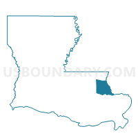
| Name | Precinct C07 |
| County | St. Tammany Parish |
| State | Louisiana |
| Area (square miles) | 0.22 |
| Land Area (square miles) | 0.22 |
| Water Area (square miles) | 0.00 |
| % of Land Area | 100.00 |
| % of Water Area | 0.00 |
| Latitude of the Internal Point | 30.48217000 |
| Longtitude of the Internal Point | -90.09995480 |
Maps


Graphs
Select a template below for downloading or customizing gragh for Precinct C07, St. Tammany Parish, Louisiana


Neighbors
Neighoring Voting District (by Name) Neighboring Voting District on the Map
- Precinct C06, St. Tammany Parish, LA
- Precinct C08, St. Tammany Parish, LA
- Precinct C10, St. Tammany Parish, LA