


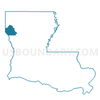
Precinct 15, De Soto Parish, Louisiana
About
Outline

Summary
| Unique Area Identifier | 588523 |
| Name | Precinct 15 |
| County | De Soto Parish |
| State | Louisiana |
| Area (square miles) | 6.01 |
| Land Area (square miles) | 5.93 |
| Water Area (square miles) | 0.09 |
| % of Land Area | 98.55 |
| % of Water Area | 1.45 |
| Latitude of the Internal Point | 32.16902770 |
| Longtitude of the Internal Point | -93.81117280 |
Maps


Graphs
Select a template below for downloading or customizing gragh for Precinct 15, De Soto Parish, Louisiana


Neighbors
Neighoring Voting District (by Name) Neighboring Voting District on the Map
- Precinct 23, De Soto Parish, LA
- Precinct 31, De Soto Parish, LA
- Precinct 32, De Soto Parish, LA
- Precinct 34, De Soto Parish, LA
- Precinct 37, De Soto Parish, LA
Top 10 Neighboring County Subdivision (by Population) Neighboring County Subdivision on the Map
- District 3, De Soto Parish, LA (3,465)
- District 1A, De Soto Parish, LA (2,567)
- District 4A, De Soto Parish, LA (2,540)