


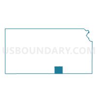
Greene Township Voting District, Sumner County, Kansas
About
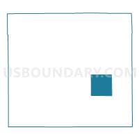
Outline

Summary
| Unique Area Identifier | 587504 |
| Name | Greene Township Voting District |
| County | Sumner County |
| State | Kansas |
| Area (square miles) | 35.93 |
| Land Area (square miles) | 35.89 |
| Water Area (square miles) | 0.04 |
| % of Land Area | 99.90 |
| % of Water Area | 0.10 |
| Latitude of the Internal Point | 37.17502230 |
| Longtitude of the Internal Point | -97.30723670 |
Maps

Graphs
Select a template below for downloading or customizing gragh for Greene Township Voting District, Sumner County, Kansas


Neighbors
Neighoring Voting District (by Name) Neighboring Voting District on the Map
- Avon Township Voting District, Sumner County, KS
- Guelph Township Voting District, Sumner County, KS
- Jackson Township Voting District, Sumner County, KS
- Oxford Township Voting District, Sumner County, KS
- South Haven Township Voting District, Sumner County, KS
- Valverde Township Voting District, Sumner County, KS
- Walton Precinct, Sumner County, KS
- Wellington Township Voting District, Sumner County, KS
Top 10 Neighboring County Subdivision (by Population) Neighboring County Subdivision on the Map
- Oxford township, Sumner County, KS (1,271)
- South Haven township, Sumner County, KS (567)
- Walton township, Sumner County, KS (361)
- Wellington township, Sumner County, KS (360)
- Avon township, Sumner County, KS (317)
- Guelph township, Sumner County, KS (184)
- Jackson township, Sumner County, KS (140)
- Valverde township, Sumner County, KS (117)
- Greene township, Sumner County, KS (75)
Top 10 Neighboring Unified School District (by Population) Neighboring Unified School District on the Map
- Wellington Unified School District 353, KS (9,665)
- Oxford Unified School District 358, KS (1,883)
- South Haven Unified School District 509, KS (879)
Top 10 Neighboring State Legislative District Lower Chamber (by Population) Neighboring State Legislative District Lower Chamber on the Map
Top 10 Neighboring State Legislative District Upper Chamber (by Population) Neighboring State Legislative District Upper Chamber on the Map
Top 10 Neighboring 111th Congressional District (by Population) Neighboring 111th Congressional District on the Map
Top 10 Neighboring Census Tract (by Population) Neighboring Census Tract on the Map
- Census Tract 9625, Sumner County, KS (4,373)
- Census Tract 9623, Sumner County, KS (2,568)
- Census Tract 9626, Sumner County, KS (2,316)