


Sumner Township Voting District, Sumner County, Kansas
About
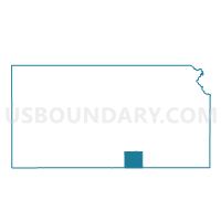
Outline

Summary
| Unique Area Identifier | 587487 |
| Name | Sumner Township Voting District |
| County | Sumner County |
| State | Kansas |
| Area (square miles) | 36.18 |
| Land Area (square miles) | 36.18 |
| Water Area (square miles) | 0.00 |
| % of Land Area | 100.00 |
| % of Water Area | 0.00 |
| Latitude of the Internal Point | 37.34470100 |
| Longtitude of the Internal Point | -97.53047380 |
Maps


Graphs
Select a template below for downloading or customizing gragh for Sumner Township Voting District, Sumner County, Kansas


Neighbors
Neighoring Voting District (by Name) Neighboring Voting District on the Map
- Illinois Township Voting District, Sumner County, KS
- London Township Voting District, Sumner County, KS
- Osborne Township Voting District, Sumner County, KS
- Ryan Township Voting District, Sumner County, KS
- Seventy - Six Township Voting District, Sumner County, KS
- Springdale Township Voting District, Sumner County, KS
- Wellington Township Voting District, Sumner County, KS
Top 10 Neighboring County Subdivision (by Population) Neighboring County Subdivision on the Map
- Springdale township, Sumner County, KS (753)
- London township, Sumner County, KS (716)
- Wellington township, Sumner County, KS (360)
- Osborne township, Sumner County, KS (257)
- Seventy-Six township, Sumner County, KS (245)
- Ryan township, Sumner County, KS (177)
- Illinois township, Sumner County, KS (173)
- Sumner township, Sumner County, KS (124)
Top 10 Neighboring Unified School District (by Population) Neighboring Unified School District on the Map
- Wellington Unified School District 353, KS (9,665)
- Conway Springs Unified School District 356, KS (2,665)
- Argonia Public Schools Unified School District 359, KS (1,029)