


Lyons Ward 3, Rice County, Kansas
About
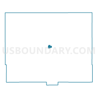
Outline

Summary
| Unique Area Identifier | 586481 |
| Name | Lyons Ward 3 |
| County | Rice County |
| State | Kansas |
| Area (square miles) | 0.80 |
| Land Area (square miles) | 0.80 |
| Water Area (square miles) | 0.00 |
| % of Land Area | 100.00 |
| % of Water Area | 0.00 |
| Latitude of the Internal Point | 38.34814650 |
| Longtitude of the Internal Point | -98.19932900 |
Maps


Graphs
Select a template below for downloading or customizing gragh for Lyons Ward 3, Rice County, Kansas


Neighbors
Neighoring Voting District (by Name) Neighboring Voting District on the Map
- Atlanta Township Voting District, Rice County, KS
- Harrison Township Voting District, Rice County, KS
- Lyons Ward 1, Rice County, KS
- Lyons Ward 2, Rice County, KS
- Lyons Ward 4, Rice County, KS
Top 10 Neighboring County Subdivision (by Population) Neighboring County Subdivision on the Map
- Lyons city, Rice County, KS (3,739)
- Harrison township, Rice County, KS (171)
- Atlanta township, Rice County, KS (134)