


Township 9 Voting District, Morris County, Kansas
About
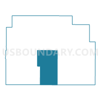
Outline

Summary
| Unique Area Identifier | 586039 |
| Name | Township 9 Voting District |
| County | Morris County |
| State | Kansas |
| Area (square miles) | 77.65 |
| Land Area (square miles) | 77.39 |
| Water Area (square miles) | 0.26 |
| % of Land Area | 99.67 |
| % of Water Area | 0.33 |
| Latitude of the Internal Point | 38.61798260 |
| Longtitude of the Internal Point | -96.66025520 |
Maps


Graphs
Select a template below for downloading or customizing gragh for Township 9 Voting District, Morris County, Kansas


Neighbors
Neighoring Voting District (by Name) Neighboring Voting District on the Map
- Diamond Township Voting District, Chase County, KS
- Highland Township Voting District, Morris County, KS
- Township 1 Precinct 1, Morris County, KS
- Township 2 Voting District, Morris County, KS
- Township 4 Voting District, Morris County, KS
- Township 7 Voting District, Morris County, KS
- Township 8 Voting District, Morris County, KS
- West Strong Township Voting District, Chase County, KS
Top 10 Neighboring County Subdivision (by Population) Neighboring County Subdivision on the Map
- Township 2, Morris County, KS (720)
- Strong township, Chase County, KS (634)
- Township 1, Morris County, KS (509)
- Township 9, Morris County, KS (307)
- Township 7, Morris County, KS (262)
- Diamond Creek township, Chase County, KS (241)
- Township 4, Morris County, KS (236)
- Township 8, Morris County, KS (206)
- Highland township, Morris County, KS (98)
Top 10 Neighboring Place (by Population) Neighboring Place on the Map
Top 10 Neighboring Unified School District (by Population) Neighboring Unified School District on the Map
- Morris County Unified School District 417, KS (5,144)
- Chase County Unified School District 284, KS (2,801)
- Rural Vista Unified School District 481, KS (2,239)
- Centre Unified School District 397, KS (1,554)
Top 10 Neighboring State Legislative District Lower Chamber (by Population) Neighboring State Legislative District Lower Chamber on the Map
Top 10 Neighboring State Legislative District Upper Chamber (by Population) Neighboring State Legislative District Upper Chamber on the Map
Top 10 Neighboring 111th Congressional District (by Population) Neighboring 111th Congressional District on the Map
Top 10 Neighboring Census Tract (by Population) Neighboring Census Tract on the Map
Top 10 Neighboring 5-Digit ZIP Code Tabulation Area (by Population) Neighboring 5-Digit ZIP Code Tabulation Area on the Map
- 66846, KS (3,504)
- 67449, KS (3,351)
- 66872, KS (1,134)
- 66869, KS (748)
- 66873, KS (319)
- 66850, KS (228)
- 66838, KS (182)