


Olive Township Voting District, Decatur County, Kansas
About
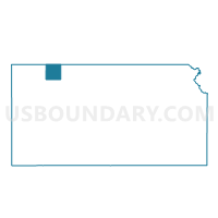
Outline

Summary
| Unique Area Identifier | 584459 |
| Name | Olive Township Voting District |
| County | Decatur County |
| State | Kansas |
| Area (square miles) | 35.65 |
| Land Area (square miles) | 35.42 |
| Water Area (square miles) | 0.23 |
| % of Land Area | 99.36 |
| % of Water Area | 0.64 |
| Latitude of the Internal Point | 39.87120230 |
| Longtitude of the Internal Point | -100.44678080 |
Maps


Graphs
Select a template below for downloading or customizing gragh for Olive Township Voting District, Decatur County, Kansas


Neighbors
Neighoring Voting District (by Name) Neighboring Voting District on the Map
- Altory Township Voting District, Decatur County, KS
- Beaver Township Voting District, Decatur County, KS
- Center Township Voting District, Decatur County, KS
- Harlan Township Voting District, Decatur County, KS
- Liberty Township Voting District, Decatur County, KS
- Oberlin City Precinct 2, Decatur County, KS
- Oberlin City Precinct 2 Exclave, Decatur County, KS
- Roosevelt Township Voting District, Decatur County, KS
- Sherman Township Voting District, Decatur County, KS
Top 10 Neighboring County Subdivision (by Population) Neighboring County Subdivision on the Map
- Oberlin city, Decatur County, KS (1,788)
- Beaver township, Decatur County, KS (82)
- Center township, Decatur County, KS (58)
- Liberty township, Decatur County, KS (51)
- Olive township, Decatur County, KS (33)
- Harlan township, Decatur County, KS (21)
- Altory township, Decatur County, KS (18)
- Roosevelt township, Decatur County, KS (18)
- Sherman township, Decatur County, KS (14)