


Powell Township Voting District, Comanche County, Kansas
About
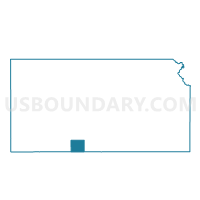
Outline

Summary
| Unique Area Identifier | 584319 |
| Name | Powell Township Voting District |
| County | Comanche County |
| State | Kansas |
| Area (square miles) | 71.85 |
| Land Area (square miles) | 71.82 |
| Water Area (square miles) | 0.02 |
| % of Land Area | 99.97 |
| % of Water Area | 0.03 |
| Latitude of the Internal Point | 37.35358270 |
| Longtitude of the Internal Point | -99.09238930 |
Maps


Graphs
Select a template below for downloading or customizing gragh for Powell Township Voting District, Comanche County, Kansas


Neighbors
Neighoring Voting District (by Name) Neighboring Voting District on the Map
- Belvidere Voting District, Kiowa County, KS
- Center I Voting District, Kiowa County, KS
- Coldwater Township Voting District, Comanche County, KS
- Deerhead Township Voting District, Barber County, KS
- Sun City Township Voting District, Barber County, KS
- Turkey Creek Township Voting District, Barber County, KS
Top 10 Neighboring County Subdivision (by Population) Neighboring County Subdivision on the Map
- Kiowa Rural township, Kiowa County, KS (2,553)
- Coldwater township, Comanche County, KS (1,048)
- Powell township, Comanche County, KS (82)
- Sun City township, Barber County, KS (68)
- Turkey Creek township, Barber County, KS (26)
- Deerhead township, Barber County, KS (14)
Top 10 Neighboring Place (by Population) Neighboring Place on the Map
Top 10 Neighboring Unified School District (by Population) Neighboring Unified School District on the Map
- Barber County North Unified School District 254, KS (3,307)
- Comanche County Unified School District 300, KS (1,926)
- Haviland Unified School District 474, KS (898)
Top 10 Neighboring State Legislative District Lower Chamber (by Population) Neighboring State Legislative District Lower Chamber on the Map
Top 10 Neighboring State Legislative District Upper Chamber (by Population) Neighboring State Legislative District Upper Chamber on the Map
Top 10 Neighboring 111th Congressional District (by Population) Neighboring 111th Congressional District on the Map
Top 10 Neighboring Census Tract (by Population) Neighboring Census Tract on the Map
- Census Tract 9681, Barber County, KS (3,138)
- Census Tract 9691, Kiowa County, KS (2,553)
- Census Tract 9676, Comanche County, KS (1,891)