


Calhoun Township Voting District, Cheyenne County, Kansas
About
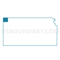
Outline

Summary
| Unique Area Identifier | 584226 |
| Name | Calhoun Township Voting District |
| County | Cheyenne County |
| State | Kansas |
| Area (square miles) | 89.84 |
| Land Area (square miles) | 89.21 |
| Water Area (square miles) | 0.63 |
| % of Land Area | 99.30 |
| % of Water Area | 0.70 |
| Latitude of the Internal Point | 39.92769770 |
| Longtitude of the Internal Point | -101.67825510 |
Maps


Graphs
Select a template below for downloading or customizing gragh for Calhoun Township Voting District, Cheyenne County, Kansas


Neighbors
Neighoring Voting District (by Name) Neighboring Voting District on the Map
- Bird City Township Voting District, Cheyenne County, KS
- Cleveland Run Township Voting District, Cheyenne County, KS
- District 3, Dundy County, NE
- Orlando Township Voting District, Cheyenne County, KS
- Wano 1 Township Voting District, Cheyenne County, KS
Top 10 Neighboring County Subdivision (by Population) Neighboring County Subdivision on the Map
- Wano township, Cheyenne County, KS (1,839)
- Bird City township, Cheyenne County, KS (687)
- Benkelman No. 3 precinct, Dundy County, NE (310)
- Cleveland Run township, Cheyenne County, KS (54)
- Orlando township, Cheyenne County, KS (49)
- Calhoun township, Cheyenne County, KS (36)
Top 10 Neighboring Unified School District (by Population) Neighboring Unified School District on the Map
- Dundy County Public Schools, NE (2,501)
- St. Francis Community Schools Unified School District 297, KS (2,016)
- Cheylin Unified School District 103, KS (1,065)