


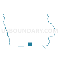
CLIO Voting District, Wayne County, Iowa
About
Outline

Summary
| Unique Area Identifier | 583673 |
| Name | CLIO Voting District |
| County | Wayne County |
| State | Iowa |
| Area (square miles) | 0.75 |
| Land Area (square miles) | 0.75 |
| Water Area (square miles) | 0.00 |
| % of Land Area | 100.00 |
| % of Water Area | 0.00 |
| Latitude of the Internal Point | 40.63597430 |
| Longtitude of the Internal Point | -93.45139240 |
Maps


Graphs
Select a template below for downloading or customizing gragh for CLIO Voting District, Wayne County, Iowa


Neighbors
Neighoring Voting District (by Name) Neighboring Voting District on the Map
- CLINTON TWP Voting District, Wayne County, IA
- GRAND RIVER TWP W/O CLIO Voting District, Wayne County, IA
- JEFFERSON TWP W/O CLIO Voting District, Wayne County, IA
- WARREN TWP Voting District, Wayne County, IA
Top 10 Neighboring County Subdivision (by Population) Neighboring County Subdivision on the Map
- Warren township, Wayne County, IA (655)
- Grand River township, Wayne County, IA (357)
- Jefferson township, Wayne County, IA (152)
- Clinton township, Wayne County, IA (76)