


UNION TWP Voting District, Union County, Iowa
About
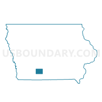
Outline

Summary
| Unique Area Identifier | 583574 |
| Name | UNION TWP Voting District |
| County | Union County |
| State | Iowa |
| Area (square miles) | 35.26 |
| Land Area (square miles) | 35.21 |
| Water Area (square miles) | 0.05 |
| % of Land Area | 99.86 |
| % of Water Area | 0.14 |
| Latitude of the Internal Point | 41.02619050 |
| Longtitude of the Internal Point | -94.18336960 |
Maps


Graphs
Select a template below for downloading or customizing gragh for UNION TWP Voting District, Union County, Iowa


Neighbors
Neighoring Voting District (by Name) Neighboring Voting District on the Map
- DODGE TWP Voting District, Union County, IA
- GRANT TWP W/O SHANNON CITY Voting District, Union County, IA
- HIGHLAND TWP Voting District, Union County, IA
- JONES TWP Voting District, Union County, IA
- LINCOLN TWP Voting District, Union County, IA
- NEW HOPE TWP Voting District, Union County, IA
- PLEASANT TWP Voting District, Union County, IA
- SAND CREEK TWP Voting District, Union County, IA
Top 10 Neighboring County Subdivision (by Population) Neighboring County Subdivision on the Map
- Union township, Union County, IA (1,224)
- New Hope township, Union County, IA (623)
- Lincoln township, Union County, IA (336)
- Highland township, Union County, IA (284)
- Grant township, Union County, IA (265)
- Jones township, Union County, IA (262)
- Sand Creek township, Union County, IA (243)
- Dodge township, Union County, IA (209)
- Pleasant township, Union County, IA (110)