


WASHINGTON TWP Voting District, Taylor County, Iowa
About
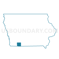
Outline

Summary
| Unique Area Identifier | 583557 |
| Name | WASHINGTON TWP Voting District |
| County | Taylor County |
| State | Iowa |
| Area (square miles) | 35.70 |
| Land Area (square miles) | 35.53 |
| Water Area (square miles) | 0.17 |
| % of Land Area | 99.53 |
| % of Water Area | 0.47 |
| Latitude of the Internal Point | 40.76630340 |
| Longtitude of the Internal Point | -94.76538250 |
Maps


Graphs
Select a template below for downloading or customizing gragh for WASHINGTON TWP Voting District, Taylor County, Iowa


Neighbors
Neighoring Voting District (by Name) Neighboring Voting District on the Map
- BENTON TWP Voting District, Taylor County, IA
- DALLAS TWP W/O NEW MARKET Voting District, Taylor County, IA
- GROVE TWP Voting District, Taylor County, IA
- HOLT TWP Voting District, Taylor County, IA
- MARSHALL TWP Voting District, Taylor County, IA
- MASON TWP Voting District, Taylor County, IA
- NODAWAY TWP Voting District, Taylor County, IA
Top 10 Neighboring County Subdivision (by Population) Neighboring County Subdivision on the Map
- Dallas township, Taylor County, IA (606)
- Washington township, Taylor County, IA (353)
- Marshall township, Taylor County, IA (214)
- Mason township, Taylor County, IA (164)
- Holt township, Taylor County, IA (152)
- Benton township, Taylor County, IA (146)
- Grove township, Taylor County, IA (134)
- Nodaway township, Taylor County, IA (133)
Top 10 Neighboring Place (by Population) Neighboring Place on the Map
Top 10 Neighboring Unified School District (by Population) Neighboring Unified School District on the Map
- Corning Community School District, IA (2,914)
- Bedford Community School District, IA (2,894)
- Lenox Community School District, IA (2,106)
- New Market Community School District, IA (957)